
















Artemis II Lunar Close-Up Images: NASA’s Lunar Science Goals
Apr 9, 2026
Soumyadeep Mukherjee
Soumyadeep Mukherjee is an award-winning astrophotographer from India. He has a doctorate degree in Linguistics. His work extends to the sub-genres of nightscape, deep sky, solar, lunar and optical phenomenon photography. He is also a photography educator and has conducted numerous workshops. His works have appeared in over 40 books & magazines including Astronomy, BBC Sky at Night, Sky & Telescope among others, and in various websites including National Geographic, NASA, Forbes. He was the first Indian to win “Astronomy Photographer of the Year” award in a major category.
Share:
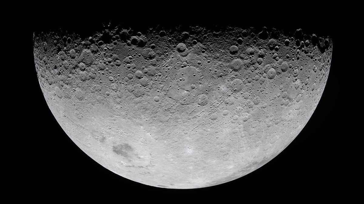
NASA designed the Artemis II mission as the first crewed test of the Orion spacecraft beyond low Earth orbit. A key part of the mission involved astronaut-directed photography of the Moon during the spacecraft’s lunar flyby. These close-up images form a structured dataset that supports geological interpretation, landing-site preparation, navigation validation, and astronaut training for upcoming surface missions.
The photographs represent the first systematic human imaging of the Moon from deep space since the Apollo program. However, unlike Apollo-era photography, the Artemis II imaging campaign utilized modern digital sensors and followed observation targets selected by scientists and mission planners before launch.
An observation campaign during the lunar flyby
During the lunar flyby phase, the Orion spacecraft passed roughly 7,400 kilometers above the lunar surface. From this position, astronauts conducted several hours of continuous observation and imaging while the spacecraft moved across the near-side and far-side viewing geometry.
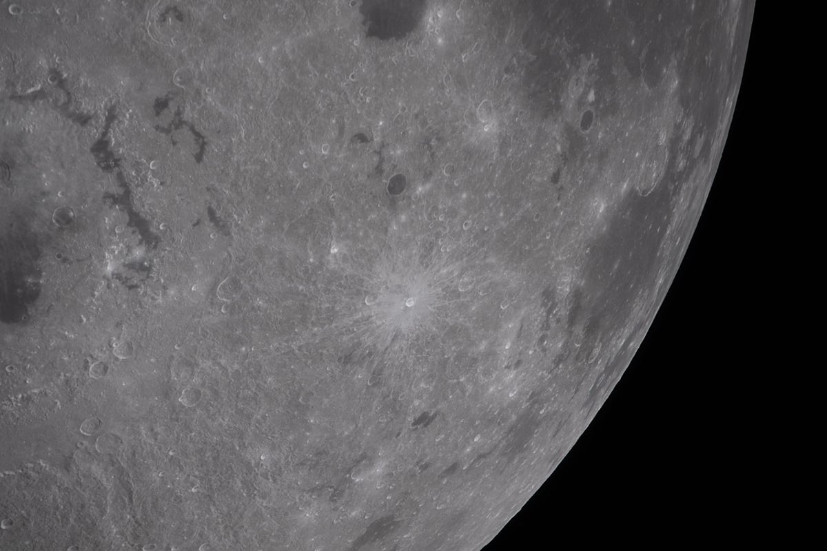
NASA planned these observations before launch. Mission teams selected about thirty surface regions as priority imaging targets along the flyby path. These targets included cratered highlands, basin boundaries, limb regions, and terrain with relevance to future landing operations.
Astronauts followed a coordinated observation sequence prepared by scientists on the ground. At the same time, they adjusted exposure settings and viewing directions as lighting conditions changed during the flyby. This ability to respond in real time allowed the crew to capture surface features under illumination conditions that are difficult for orbital spacecraft to observe repeatedly.
Photographing the Lunar far side from a human perspective
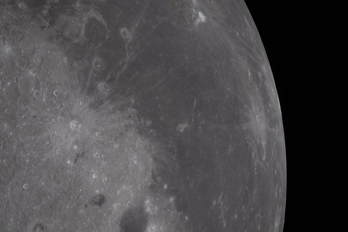
One of the most important outcomes of the observation campaign involves imaging of the lunar far side. Although robotic spacecraft mapped this hemisphere in detail over many decades, astronaut observation remains rare. Humans last viewed the far side directly during the Apollo missions.
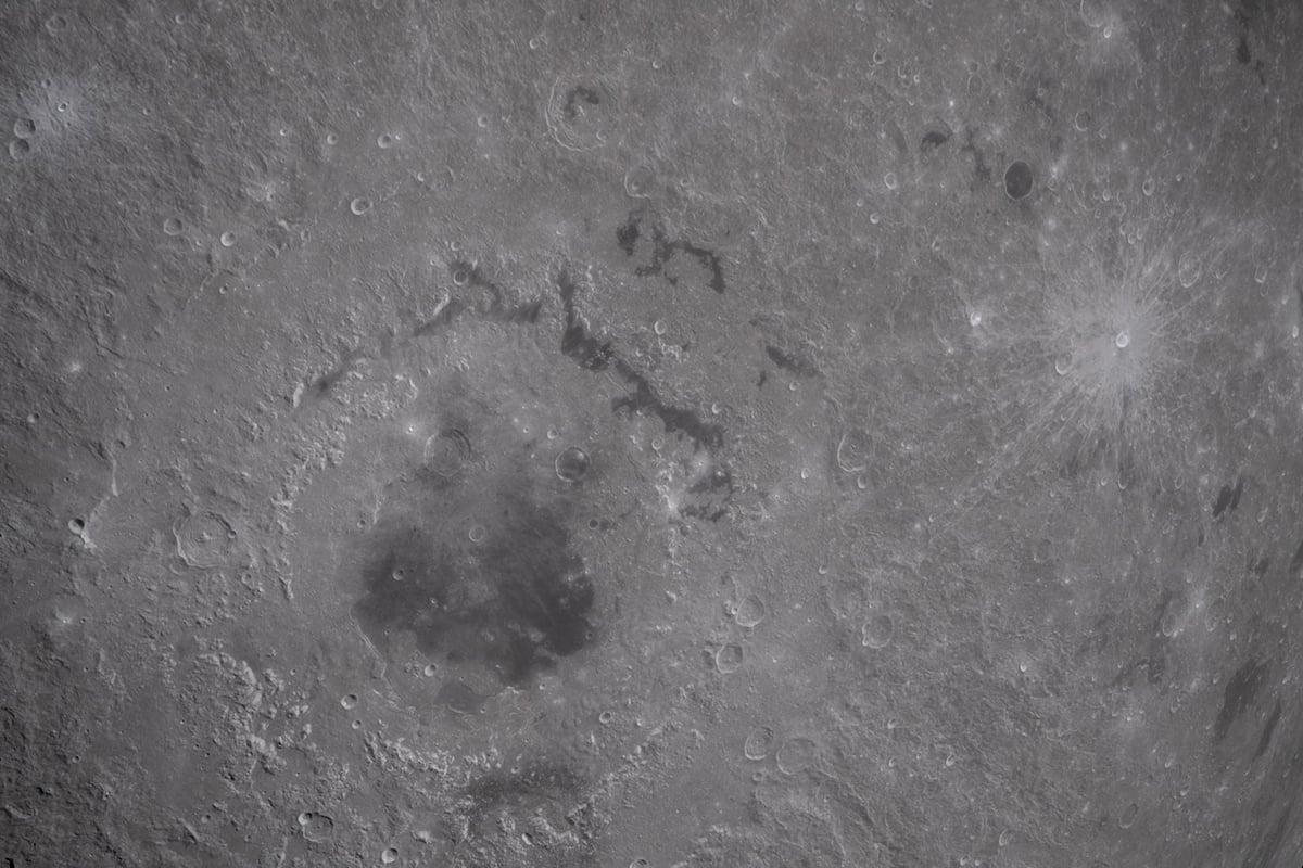
The Artemis II trajectory carried Orion across a viewing geometry that allowed astronauts to photograph heavily cratered terrain and basin structures along the far-side hemisphere. In several cases, the spacecraft passed through regions that earlier crews had not observed from comparable positions.
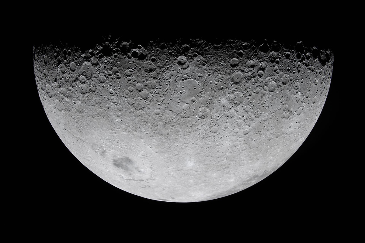
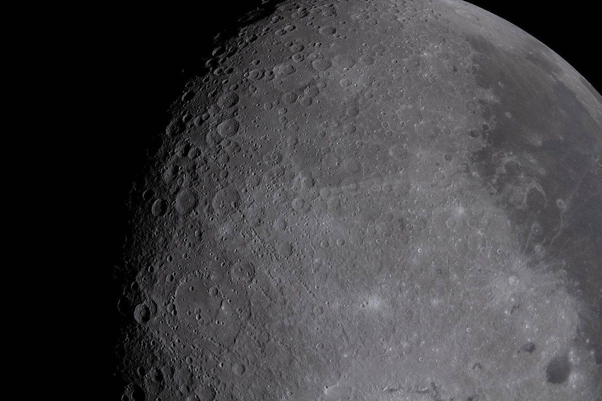
Lighting conditions during the flyby created long shadow patterns across crater rims and basin edges. These shadows improve the interpretation of surface relief and structural boundaries between geological units. Scientists often rely on such shadow geometry when studying the shape and depth of impact features.
Astronaut-directed imaging also allows researchers to compare new observations with historical Apollo photography and modern orbital datasets. This comparison improves consistency in long-term surface mapping.
Supporting geological interpretation of impact structures
Impact craters dominate the lunar surface. Understanding their structure remains essential for reconstructing the Moon’s geological history. The Artemis II imaging campaign included observations of selected crater systems along the flyby trajectory.
Astronauts photographed crater rims, ejecta blankets, and overlapping impact features under changing illumination geometry. These views help scientists identify subtle slope variations and surface textures that may appear differently under high Sun angles typically used in orbital mapping.
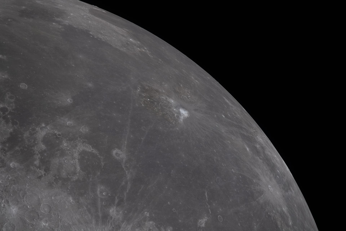
Because Orion moved rapidly along its trajectory, astronauts captured sequences of images that show the same terrain from slightly different viewing angles. Such sequences support three-dimensional interpretation of surface features.
Improving surface mapping for future landing regions
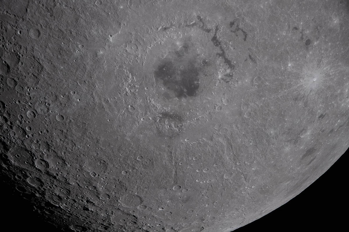
A major objective of the Artemis II lunar imaging program involved preparation for future crewed landing missions. NASA plans to land astronauts near the lunar south pole during Artemis III. Terrain in this region presents unique challenges compared with earlier Apollo landing sites.
Surface slopes vary significantly across short distances. Some regions remain permanently shadowed. Other areas receive limited sunlight during each lunar day. Understanding terrain appearance under these conditions remains essential before astronauts attempt landing operations.
Although the Artemis II spacecraft did not enter lunar orbit, the flyby provided observation geometry that allowed astronauts to examine terrain under low-angle illumination similar to conditions expected near the south pole.
Testing the role of astronauts as scientific observers
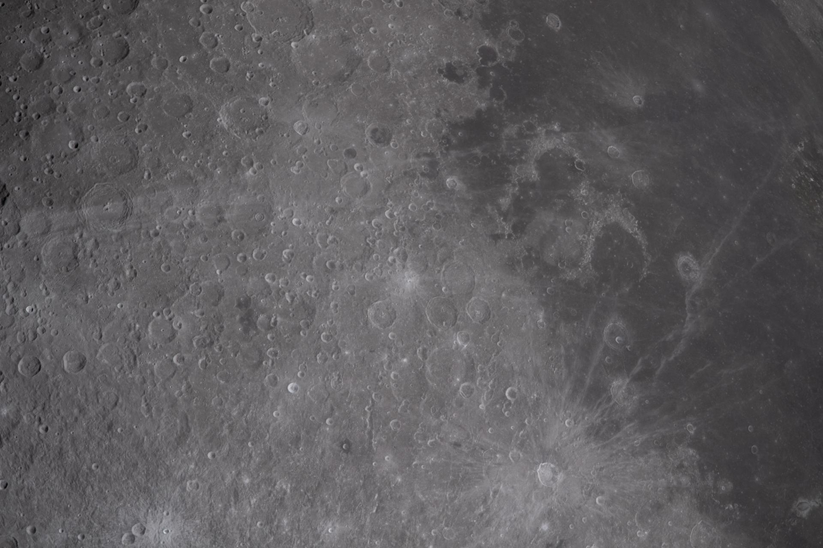
Another important goal of the imaging campaign involved evaluating how astronauts function as scientific observers during lunar-vicinity operations. Robotic spacecraft can capture high-resolution images automatically, but they cannot respond instantly to changing observation conditions.
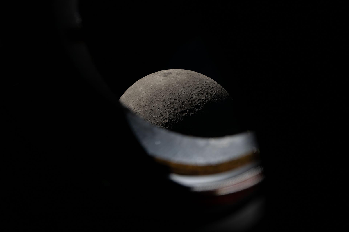
During the flyby, astronauts worked with flight controllers and scientists to capture selected surface targets along the spacecraft’s trajectory. This cooperation allowed teams on Earth to guide observations while the spacecraft remained in motion.
Engineers studied how efficiently astronauts identified terrain features through Orion’s windows and how quickly they could adjust observation sequences during flight. These results help mission planners design future observation programs for crewed missions in lunar orbit.
Preparing the scientific foundation for the next lunar landing era
The close-up lunar images captured during Artemis II form an important bridge between robotic mapping missions and upcoming crewed surface exploration. The photographs document crater systems, basin structures, limb geometry, and terrain relevant to future landing operations under illumination conditions selected for scientific interpretation.
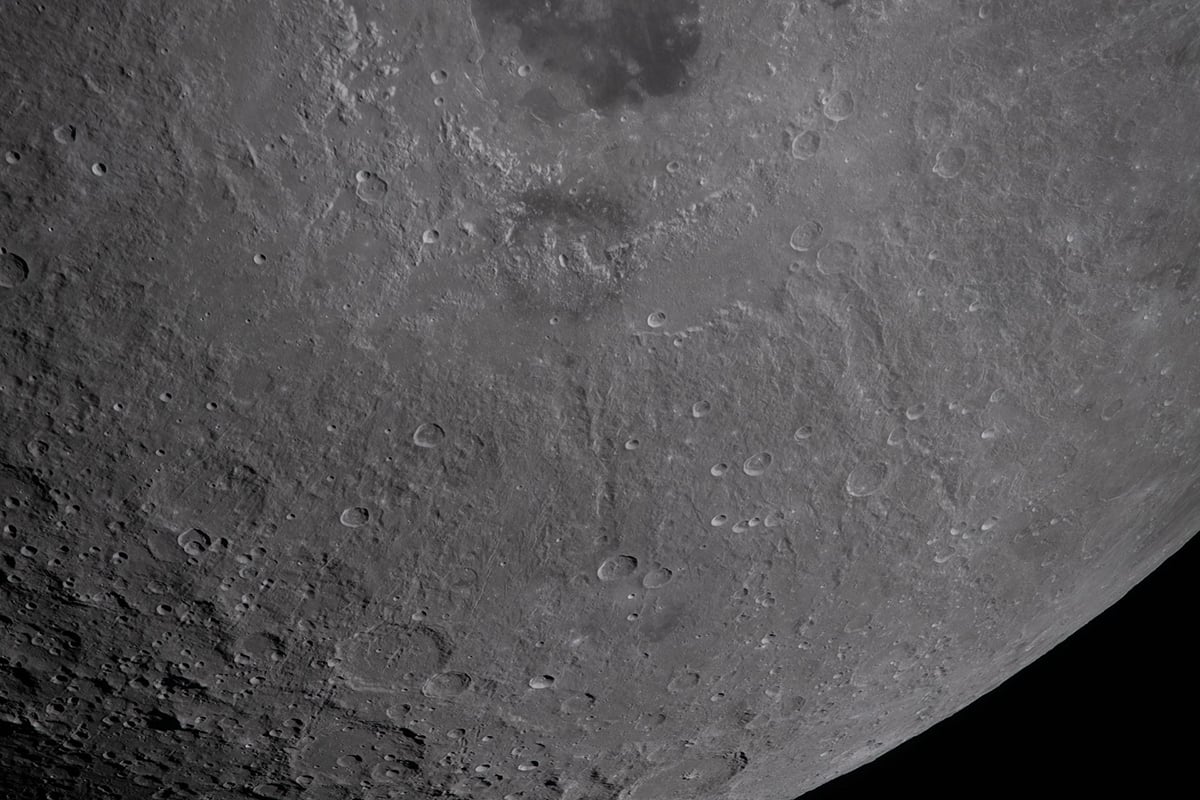
These observations strengthen geological mapping efforts, improve landing-site models, and support evaluation of astronaut observation techniques in deep space.
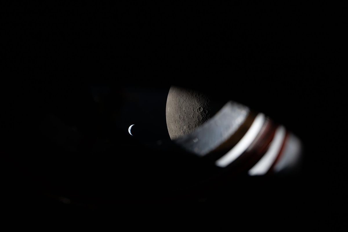
More than fifty years after Apollo astronauts last photographed the Moon from beyond Earth orbit, Artemis II showed how human observers can again contribute to lunar science from spacecraft operating near the Moon. The dataset collected during this flyby will support planning for Artemis III and help guide the next generation of lunar surface exploration.
Clear skies!
More from the Artemis II Mission
- NASA Chooses Sony as Official Camera on Artemis Lunar Missions
- NASA’s Artemis II Lifts Off for the Moon: Images of the Launch
- Artemis II Astronauts Capture Historic Earth Images from Space
- Crew Portraits with Earth, and Moon Photos from Artemis II
- Artemis II Completes Historic Lunar Flyby: New Images of the Moon
- Artemis II Lunar Close-Up Images: NASA’s Lunar Science Goals
- Earthset, Earthrise, and Eclipse: Photos from Artemis II Lunar Flyby
- Artemis II Begins Final Return to Earth After Historic Lunar Flyby
- To the Moon and Back: NASA’s Artemis II Returns Safely to Earth
- NASA Releases 12,000 Photos from Artemis II Mission: Top Picks
See more from DIYPhotography.net on Google
Add DIYPhotography.net as a trusted source. This makes
our stories more likely to appear in your Google Search results.
 Add as a preferred source on Google

Soumyadeep Mukherjee
Soumyadeep Mukherjee is an award-winning astrophotographer from India. He has a doctorate degree in Linguistics. His work extends to the sub-genres of nightscape, deep sky, solar, lunar and optical phenomenon photography. He is also a photography educator and has conducted numerous workshops. His works have appeared in over 40 books & magazines including Astronomy, BBC Sky at Night, Sky & Telescope among others, and in various websites including National Geographic, NASA, Forbes. He was the first Indian to win “Astronomy Photographer of the Year” award in a major category.


Join the Discussion
DIYP Comment Policy
Be nice, be on-topic, no personal information or flames.