























NOAA Satellite Captures Mesmerizing Northern Lights from Space
Nov 16, 2025
Soumyadeep Mukherjee
Soumyadeep Mukherjee is an award-winning astrophotographer from India. He has a doctorate degree in Linguistics. His work extends to the sub-genres of nightscape, deep sky, solar, lunar and optical phenomenon photography. He is also a photography educator and has conducted numerous workshops. His works have appeared in over 40 books & magazines including Astronomy, BBC Sky at Night, Sky & Telescope among others, and in various websites including National Geographic, NASA, Forbes. He was the first Indian to win “Astronomy Photographer of the Year” award in a major category.
Share:
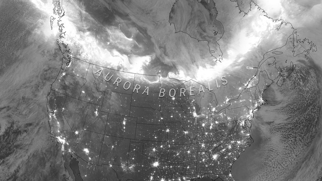
On 11 November 2025, Earth received a direct hit from a series of strong solar eruptions. The impact set off one of the most intense geomagnetic storms of the year. As the storm grew, NOAA’s satellites recorded a massive auroral display spreading across North America. The images showed an unusually bright auroral oval, a sign of how powerful the disturbance had become. The storm reached G4 level on NOAA’s scale, which counts as severe. When storms reach that level, they often create northern lights far beyond the polar regions. This event did exactly that, and the satellite data captured the scale of the moment with clear detail.
The solar eruptions behind the event
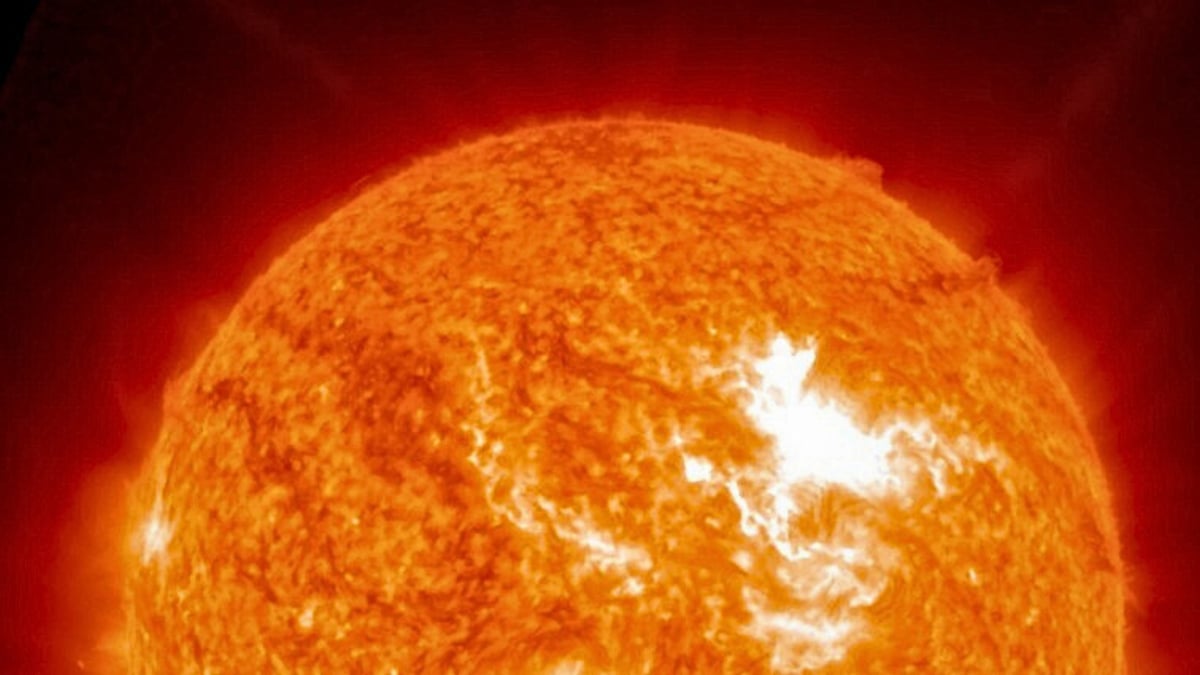
The storm began with a sequence of eruptions on the Sun. Several active regions released flares and coronal mass ejections in early November. Each CME carried a cloud of charged particles and magnetic fields. When those clouds travel through space and reach Earth, they interact with our magnetic field. The interaction causes the magnetosphere to compress, shift, and reconnect. That process funnels high-energy particles toward Earth’s poles.
NOAA’s forecasters saw the eruptions as they happened. The agency posted alerts indicating that multiple CMEs were heading toward Earth. When a CME carries a south-pointing magnetic field, it couples more strongly with Earth’s field. This coupling opens the door for more particles to enter near-Earth space. Forecasters noted that the incoming clouds looked capable of producing strong activity. As the first CME arrived on 11 November, instruments recorded rising disturbances. The situation escalated quickly as additional material from the later eruptions swept in. The combined impact fueled the severe geomagnetic storm that unfolded overnight.
Northern lights from space
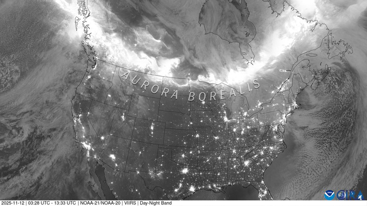
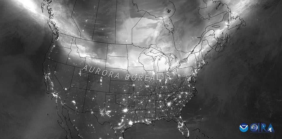
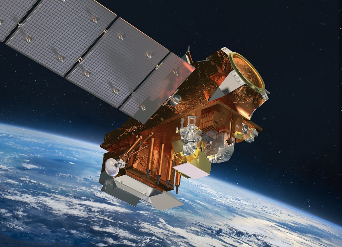
Understanding this event is easier when viewed from space. NOAA’s polar-orbiting JPSS satellite provided some of the clearest visuals. Its VIIRS instrument includes a day-night band that can detect faint nighttime light. That band can pick up city lights, moonlit clouds, and even the glow of auroras. During the storm, the instrument recorded a bright arc of auroral activity stretching across Canada and the northern United States.
The satellite composite shows the aurora’s reach in one frame. From above, the auroral oval looked wide and intense, with clear patches of concentrated brightness. That pattern reflects how solar particles enter the atmosphere along magnetic field lines. The satellite image also helps viewers compare the aurora against the lights of major cities. Even with artificial lighting below, the auroral glow appeared strong enough to stand out.
These images help scientists validate models and improve forecasts. They also help confirm which regions experienced the strongest effects. Ground observations supported what the satellite recorded. Skywatchers across many U.S. states reported visible auroras that night. The colors varied depending on location and atmospheric conditions, but many observers described green arcs, red patches, and faint pink bands near the horizon.
Auroras reached unusual latitudes
Auroras normally stay near the poles. To see them far south, conditions must align perfectly. This storm offered that combination. First, the CMEs arrived close together, which can intensify magnetic disturbances. When solar clouds pile up or interact, they create stronger and more complex shocks. Those shocks often bring fast solar wind and strong magnetic fields.
Second, the magnetic orientation of the incoming cloud played a major role. A southward magnetic field interacts much more efficiently with Earth’s field. During this storm, the field turned south for extended periods. Instruments detected strong coupling, which allowed a huge amount of energy to enter the magnetosphere. Once that energy reached Earth’s magnetic poles, it powered wide and bright auroras.
As the storm peaked, the auroral oval expanded significantly. NOAA’s data showed disturbances strong enough to push the oval deep into the continental United States. That expansion explains why many observers saw auroras in areas where they are rare. Events like this do not happen often, especially outside years of high solar activity. But when they do, the displays can stretch for thousands of kilometres.
How satellite data helps improve forecasting
NOAA’s JPSS satellites provide continuous coverage of Earth’s atmosphere and environment. Their instruments help scientists observe nighttime phenomena with clarity. The day-night band is instrumental because it detects features that are invisible to standard optical sensors. During auroral events, it creates a broad view that ground cameras cannot match.
These large-scale visuals feed into research on how CMEs interact with Earth’s magnetic field. Each storm offers new insights. When multiple CMEs collide or merge, they create complex patterns that challenge forecasting models. Satellite data help researchers understand those patterns. Better understanding leads to more accurate predictions, which benefit airlines, power companies, satellite operators, and even photographers planning northern lights trips.
The November event will likely become a reference case for future studies. Its intensity, timing, and multi-CME structure make it valuable for space-weather analysis. As solar activity continues to rise toward the cycle’s peak, similar events may occur again. Scientists will use the lessons from this storm to refine models and improve early warnings.
Clear skies!
See more from DIYPhotography.net on Google
Add DIYPhotography.net as a trusted source. This makes
our stories more likely to appear in your Google Search results.
 Add as a preferred source on Google

Soumyadeep Mukherjee
Soumyadeep Mukherjee is an award-winning astrophotographer from India. He has a doctorate degree in Linguistics. His work extends to the sub-genres of nightscape, deep sky, solar, lunar and optical phenomenon photography. He is also a photography educator and has conducted numerous workshops. His works have appeared in over 40 books & magazines including Astronomy, BBC Sky at Night, Sky & Telescope among others, and in various websites including National Geographic, NASA, Forbes. He was the first Indian to win “Astronomy Photographer of the Year” award in a major category.


Join the Discussion
DIYP Comment Policy
Be nice, be on-topic, no personal information or flames.