


ESA’s Sentinel-3 Satellite “Sees” Europe’s Heatwave from Space
Jun 16, 2026
Soumyadeep Mukherjee
Soumyadeep Mukherjee is an award-winning astrophotographer from India. He has a doctorate degree in Linguistics. His work extends to the sub-genres of nightscape, deep sky, solar, lunar and optical phenomenon photography. He is also a photography educator and has conducted numerous workshops. His works have appeared in over 40 books & magazines including Astronomy, BBC Sky at Night, Sky & Telescope among others, and in various websites including National Geographic, NASA, Forbes. He was the first Indian to win “Astronomy Photographer of the Year” award in a major category.
Share:
During the final week of May 2026, a large anticyclonic system settled over southern and central Europe and altered the continent’s thermal balance at the surface level. Persistent subsidence within the high-pressure system suppressed cloud formation, reduced atmospheric mixing, and allowed uninterrupted solar radiation to heat the ground for several consecutive days.
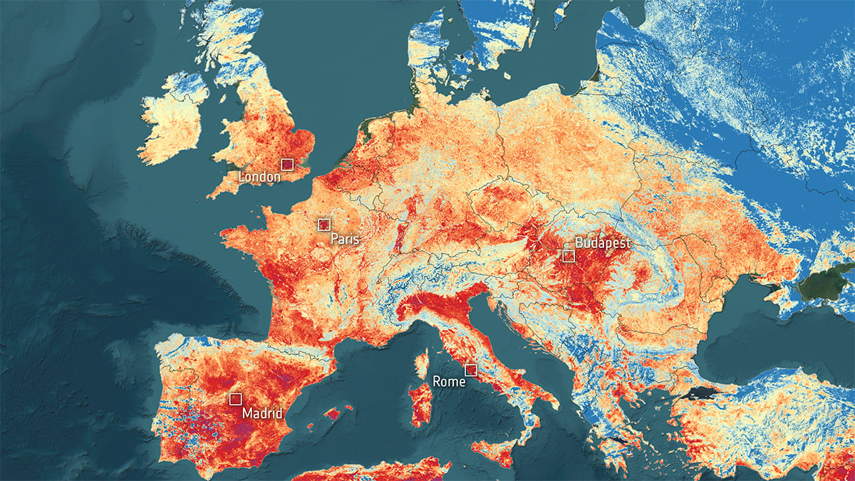
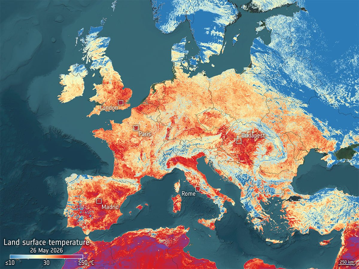
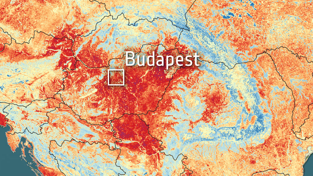
While meteorological stations recorded the atmospheric response to the event, ESA’s Sentinel-3 satellite observed the heatwave from orbit. Using thermal infrared measurements from the Sea and Land Surface Temperature Radiometer, the mission mapped the radiative temperature of Europe’s land surface during the heatwave. The resulting imagery revealed extensive thermal anomalies stretching across the continent.
Surface temperature vs. air temperature
Most public weather reports focus on air temperature measured about two meters above ground level. This value represents the temperature people experience directly and remains essential for forecasting and public safety. However, land surface temperature describes something else entirely. It measures the temperature of the actual surface under solar radiation.
Under strong sunlight, surfaces respond differently depending on their material composition and moisture content. Concrete, asphalt, rock, and dry soil absorb solar energy efficiently and heat rapidly throughout the day. Vegetation behaves differently because plants cool themselves through the process of transpiration. Moist soil also moderates heating because evaporation removes thermal energy from the ground.
When prolonged dry conditions develop, this natural cooling weakens. As a result, exposed surfaces may become dramatically hotter than the surrounding air. During intense summer conditions, asphalt roads, rooftops, and dry terrain can exceed 50 degrees Celsius even when official air temperatures remain below 40 degrees. And this was exactly the pattern Sentinel-3 observed across Europe.
The Sentinel-3 mission and thermal observation
The Sentinel-3 satellites form part of the Copernicus Earth observation programme operated by the European Union and the European Space Agency. The mission supports environmental monitoring across oceans, land surfaces, ice sheets, and the atmosphere. Among its instruments, the Sea and Land Surface Temperature Radiometer plays a major role in studying climate processes and extreme weather events.
SLSTR detects thermal infrared radiation emitted naturally by Earth’s surface. Scientists then use those measurements to calculate land and sea surface temperatures with high radiometric precision. Because the instrument observes broad areas continuously, it allows researchers to study thermal behavior across entire continents rather than isolated local measurements.
This wide coverage becomes especially valuable during large-scale heatwaves. Ground-based weather stations provide highly accurate atmospheric data, but they cannot fully capture how different surfaces respond spatially under extreme heating. Satellite observations, however, reveal where heat accumulates fastest, where cooling remains effective, and where landscapes begin experiencing severe thermal stress.
Cities are becoming thermal hotspots
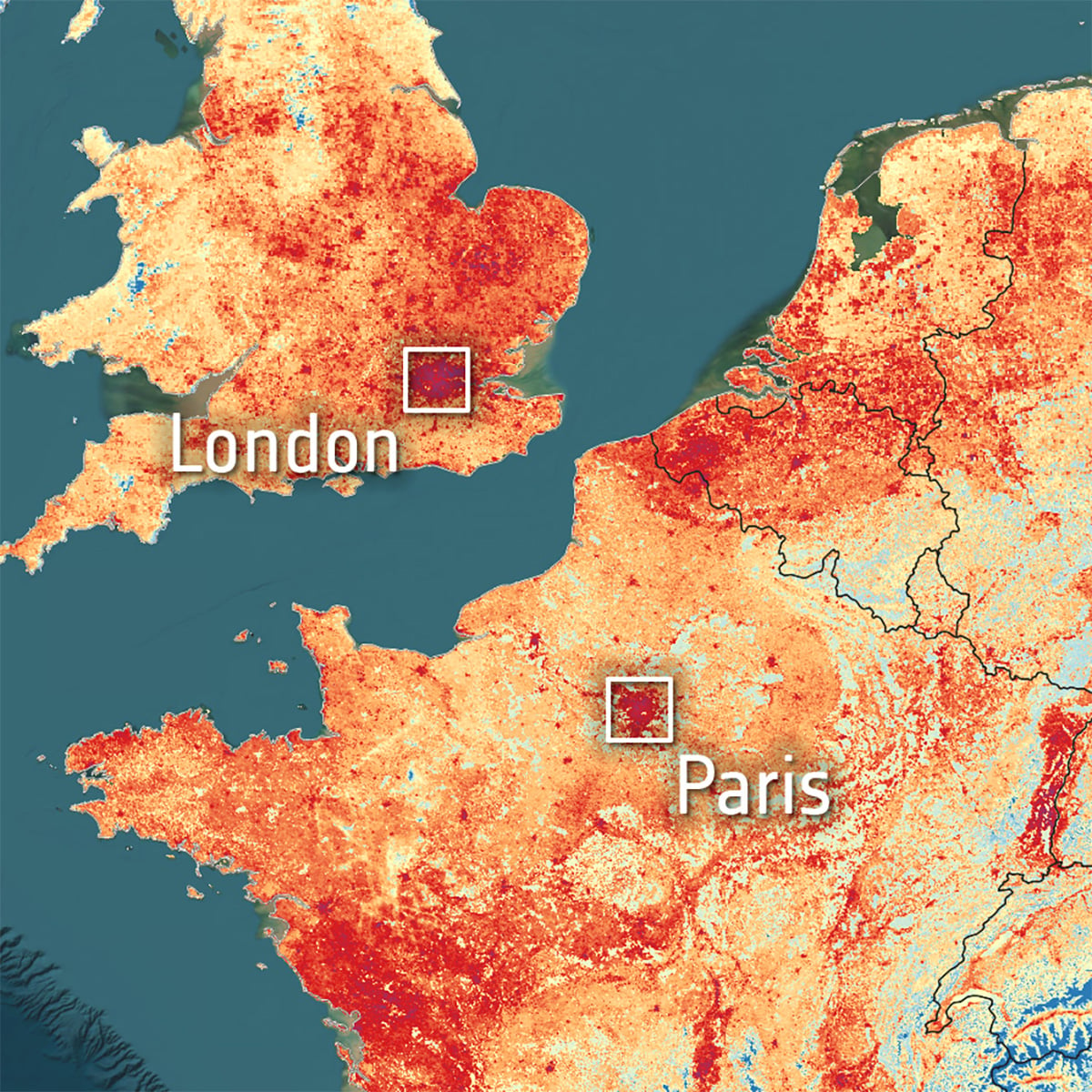
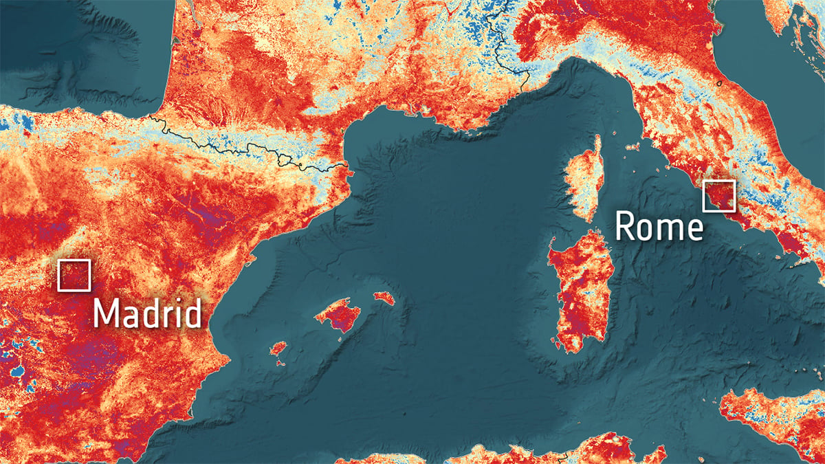
Among the most striking features in the Sentinel-3 imagery were Europe’s major urban regions. Large metropolitan areas consistently appeared hotter than surrounding rural landscapes. This phenomenon, known as the urban heat island effect, has become one of the defining environmental challenges for modern cities.
Urban construction materials absorb and store solar energy far more efficiently than natural landscapes. Asphalt roads, concrete structures, brick surfaces, and metal infrastructure accumulate heat throughout the day and release it slowly after sunset. At the same time, cities contain less vegetation and reduced soil exposure, which limits evaporative cooling.
The Sentinel-3 observations revealed how unevenly heat spreads across urban Europe. Districts with limited green cover appeared substantially hotter than surrounding suburbs or rural zones. Industrial areas and densely built city centers produced particularly strong thermal signatures. Meanwhile, parks and forested urban corridors appeared cooler and interrupted the spread of surface heating.
Clear skies!

Soumyadeep Mukherjee
Soumyadeep Mukherjee is an award-winning astrophotographer from India. He has a doctorate degree in Linguistics. His work extends to the sub-genres of nightscape, deep sky, solar, lunar and optical phenomenon photography. He is also a photography educator and has conducted numerous workshops. His works have appeared in over 40 books & magazines including Astronomy, BBC Sky at Night, Sky & Telescope among others, and in various websites including National Geographic, NASA, Forbes. He was the first Indian to win “Astronomy Photographer of the Year” award in a major category.


Join the Discussion
DIYP Comment Policy
Be nice, be on-topic, no personal information or flames.