






ESA’s Sentinel-3C Satellite Reveals Its First Images of Earth
Oct 11, 2026
Soumyadeep Mukherjee
Soumyadeep Mukherjee is an award-winning astrophotographer from India. He has a doctorate degree in Linguistics. His work extends to the sub-genres of nightscape, deep sky, solar, lunar and optical phenomenon photography. He is also a photography educator and has conducted numerous workshops. His works have appeared in over 40 books & magazines including Astronomy, BBC Sky at Night, Sky & Telescope among others, and in various websites including National Geographic, NASA, Forbes. He was the first Indian to win “Astronomy Photographer of the Year” award in a major category.
Share:
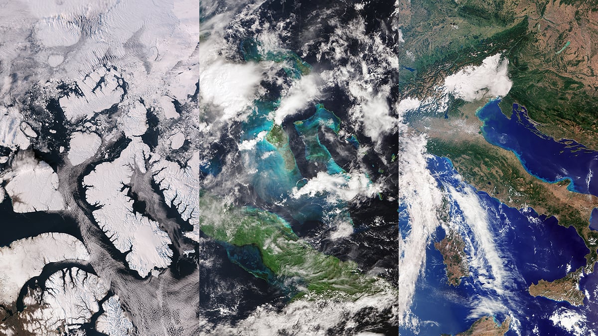
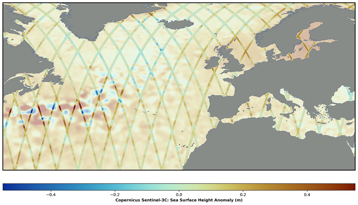
ESA’s Sentinel-3C satellite has returned its first images of Italy, the Canadian Arctic and the Caribbean. Captured in late September, the images reveal snow-covered mountains, agricultural land, Arctic islands and shallow tropical seas. The images come in less than a month after the satellite’s launch. The Sentinel-3C has also begun measuring sea-surface height and the elevation of Greenland’s ice sheet.
Sentinel-3C sends back its first images
A Vega-C rocket launched Sentinel-3C from Europe’s Spaceport in French Guiana on September 15, 2026. The rocket also carried the Fluorescence Explorer (FLEX) satellite, which will study vegetation. After reaching orbit, Sentinel-3C began a series of checks to prepare its instruments for scientific work.
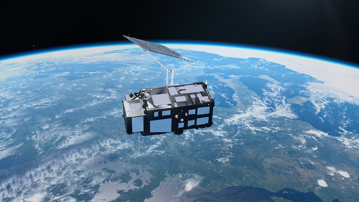
The spacecraft belongs to the European Union’s Copernicus programme, which uses satellites to monitor the planet. It is the third satellite in the Sentinel-3 series. Its predecessors collect regular measurements of ocean color, sea and land temperatures, sea level, and ice conditions. Sentinel-3C will help maintain this record as earlier spacecraft age.
The first images came from the Ocean and Land Colour Instrument (OLCI). The instrument photographed the Caribbean on September 29, followed by Italy and the Canadian Arctic Archipelago on September 30.
From the Alps to the turquoise waters of the Caribbean
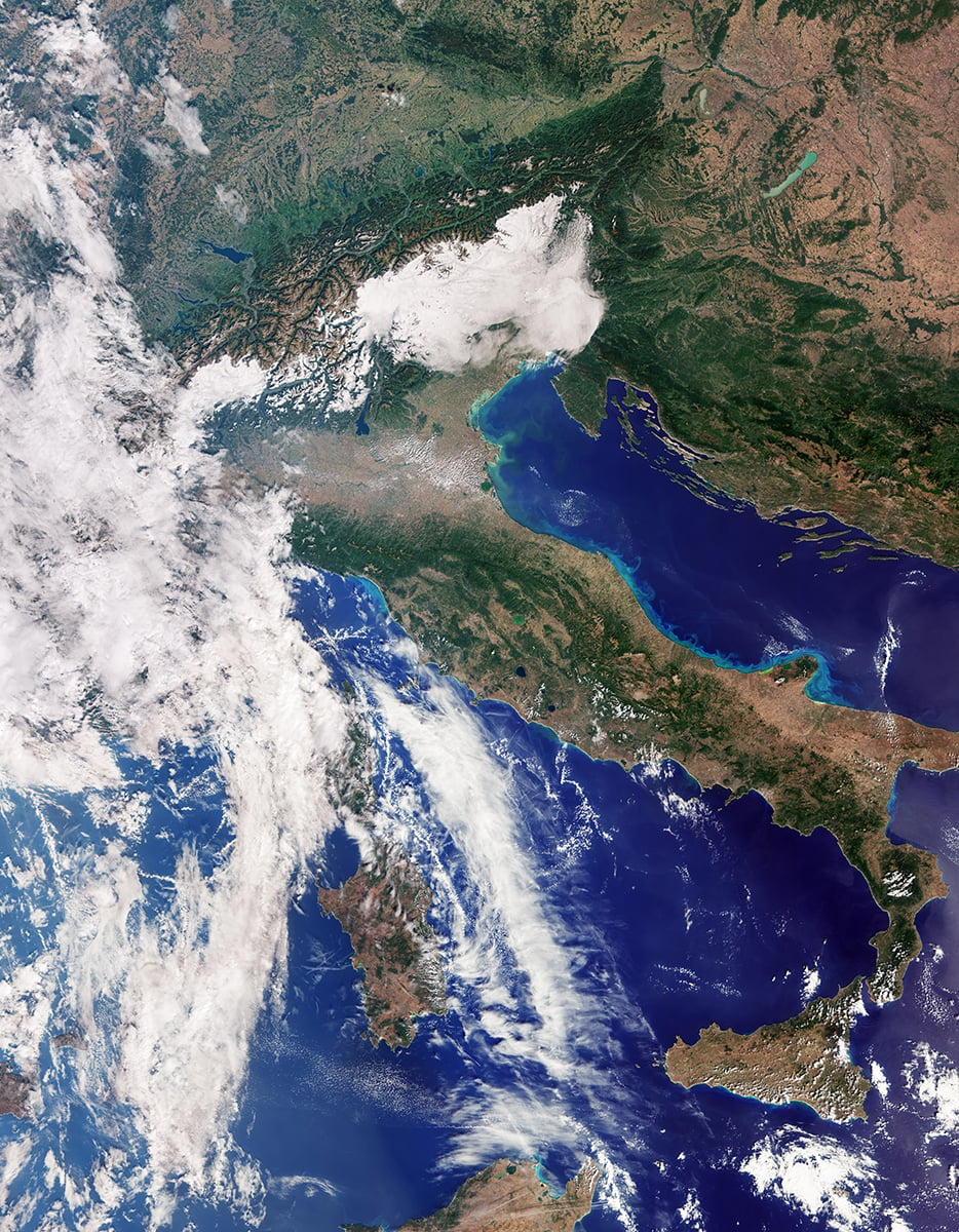
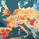
The image of Italy stretches from southern Germany to Sicily and the southern Mediterranean. The Alps dominate the northern part of the scene, with snow highlighting the mountain ranges. Below them, the Po Valley appears in shades of green and brown. This broad plain supports much of northern Italy’s agriculture, and its appearance contrasts with the surrounding mountains.
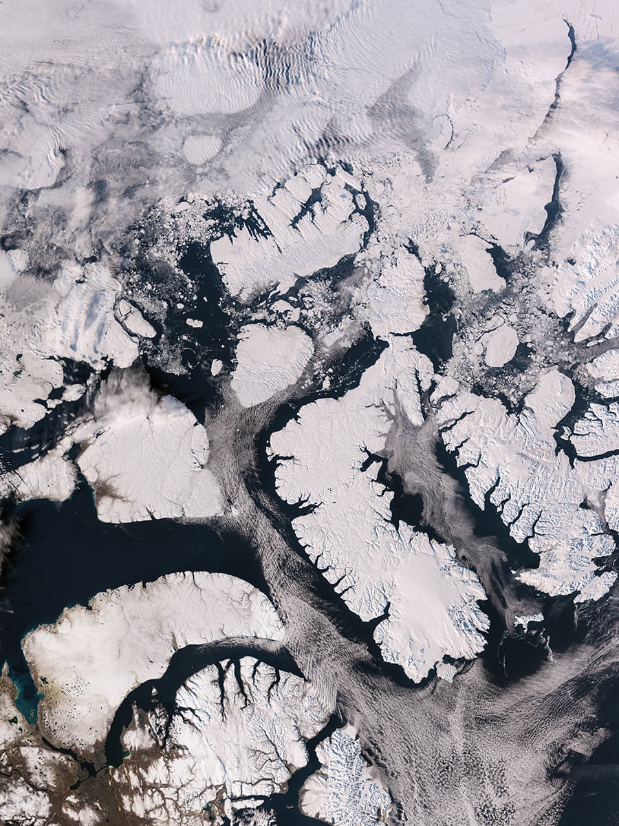
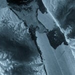
The Canadian Arctic image shows part of the Arctic Archipelago, west of Greenland. Snow and ice cover many of the islands, while exposed rock and rugged coastlines create sharp contrasts across the landscape. Deep fjords cut into the land, and fragments of sea ice float on darker open water. ESA notes that sea ice usually reaches its annual minimum around this time of year, although the exact conditions vary.
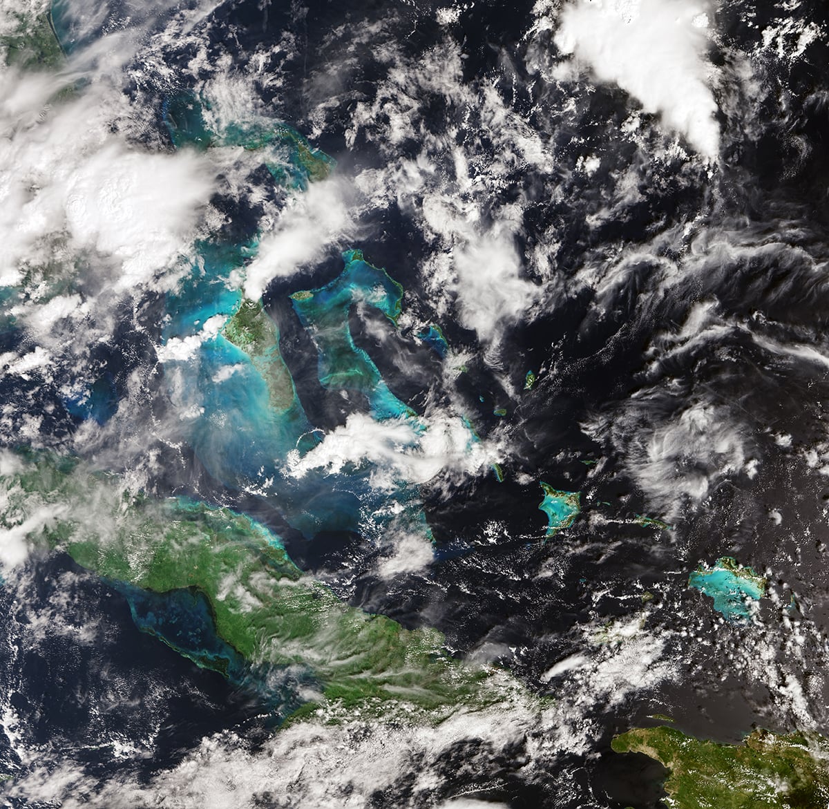
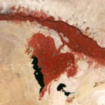
The third image shows Cuba and the Bahamas. Shallow waters around the islands appear turquoise, while the deeper ocean looks dark blue. These differences reflect the way light interacts with water, suspended particles, and the seabed. The image also shows how OLCI can capture large coastal regions in a single view.
How Sentinel-3C records Earth’s colours
The Ocean and Land Colour Instrument is designed to study the color of the oceans and the characteristics of land surfaces. It measures light in 21 spectral bands, covering wavelengths from 400 to 1,020 nanometers. This range includes visible light and extends into the near-infrared, beyond the wavelengths humans can see.
A conventional digital camera usually records red, green, and blue channels to produce a color photograph. OLCI measures additional wavelength bands, each selected to help scientists investigate particular features. The resulting data can reveal differences between vegetation, soil and water that may look similar in an ordinary image.
The instrument has a spatial resolution of 300 meters and a swath width of 1,270 kilometers. In practical terms, each pixel represents a sizeable area of ground, while each pass covers a broad strip of the planet. This allows Sentinel-3C to observe large regions regularly, rather than concentrating on individual buildings or small landscapes.
Sentinel-3C also carries a synthetic aperture radar altimeter alongside OLCI. The two instruments work differently. OLCI measures sunlight reflected from Earth, while the radar altimeter sends microwave pulses towards the surface and analyses the returning signals. By measuring the signals’ travel time, the instrument can estimate surface height.
Clear skies!
See more from DIYPhotography.net on Google
Add DIYPhotography.net as a trusted source. This makes
our stories more likely to appear in your Google Search results.
 Add as a preferred source on Google

Soumyadeep Mukherjee
Soumyadeep Mukherjee is an award-winning astrophotographer from India. He has a doctorate degree in Linguistics. His work extends to the sub-genres of nightscape, deep sky, solar, lunar and optical phenomenon photography. He is also a photography educator and has conducted numerous workshops. His works have appeared in over 40 books & magazines including Astronomy, BBC Sky at Night, Sky & Telescope among others, and in various websites including National Geographic, NASA, Forbes. He was the first Indian to win “Astronomy Photographer of the Year” award in a major category.

Join the Discussion
DIYP Comment Policy
Be nice, be on-topic, no personal information or flames.