





















ESA Satellites Capture Wildfires, Drought and Extreme Heat from Space
Sep 6, 2026
Soumyadeep Mukherjee
Soumyadeep Mukherjee is an award-winning astrophotographer from India. He has a doctorate degree in Linguistics. His work extends to the sub-genres of nightscape, deep sky, solar, lunar and optical phenomenon photography. He is also a photography educator and has conducted numerous workshops. His works have appeared in over 40 books & magazines including Astronomy, BBC Sky at Night, Sky & Telescope among others, and in various websites including National Geographic, NASA, Forbes. He was the first Indian to win “Astronomy Photographer of the Year” award in a major category.
Share:
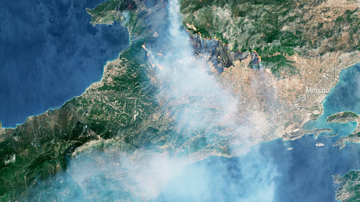
In 2026, parts of Europe, North America, and other regions have faced intense heat, dry conditions, and widespread wildfires. The European Space Agency (ESA) has been following these events through a collection of satellite observations covering wildfires, drought, and extreme heat. Their new collection of images shows the hot Earth from space.
The images come from several missions operated through the European Union’s Copernicus programme, along with ESA’s EarthCARE mission. And each of these spacecrafts are supposed to observe Earth in a different way. Some measure visible light while others detect thermal radiation or gases in the atmosphere. EarthCARE can also study the vertical distribution of smoke and aerosols.
Sentinel-3: Extreme heat affecting the ground
One of the best examples came during a European heatwave in June. On 23 June, the Copernicus Sentinel-3 satellite recorded land-surface temperatures as high as 55°C across parts of central Spain, western France, and northern Africa.
The measurement can be easy to misunderstand because it is not the temperature shown in a normal weather forecast. Weather stations measure the temperature of the air. Sentinel-3 was measuring the temperature of the surface itself.
The June observations showed just how large the difference could become. Sentinel-3 recorded a land-surface temperature of 48°C around Madrid, while Rome reached 44°C. Poitiers in France and Zaragoza in Spain both reached 46°C. Around Tunis, the surface temperature reached 49°C.
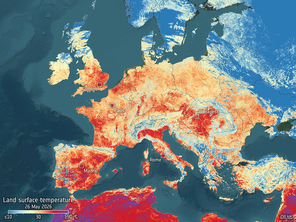
Sentinel-3 makes these observations with its Sea and Land Surface Temperature Radiometer, known as SLSTR. The instrument observes thermal infrared wavelengths and can measure temperatures across large areas.
Sentinel-2: Changing landscape with wildfire
The Copernicus Sentinel-2 mission carries a multispectral instrument with 13 spectral bands. Several of these bands extend beyond visible light into the infrared part of the spectrum. This allows the satellite to detect changes in vegetation that may not be obvious in an ordinary photograph.
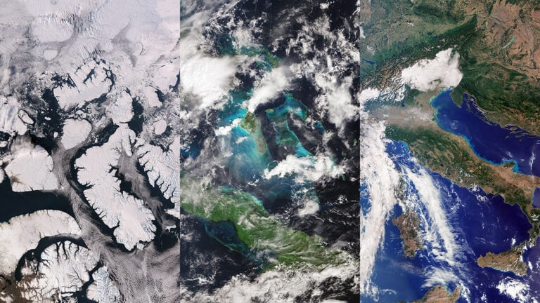
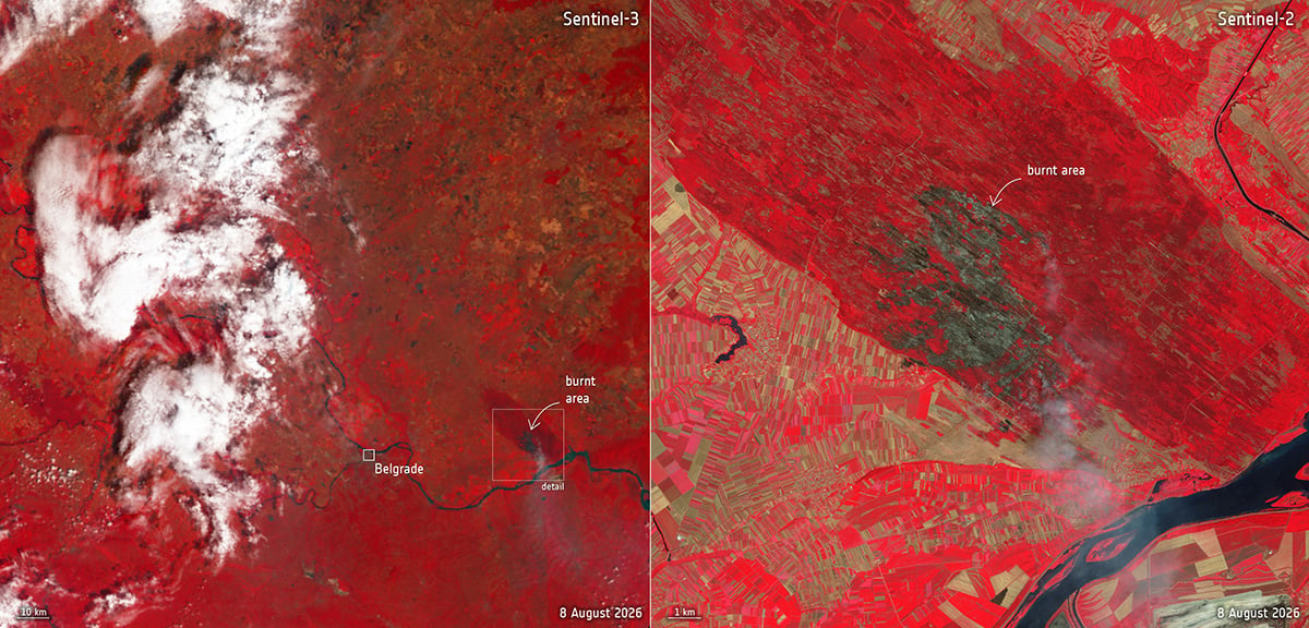
Sentinel-2 has been used extensively to document the fires affecting Europe during the summer. One image from 26 July showed fires around Ávila, northwest of Madrid, as smoke spread across central Spain.
The fires were severe enough to trigger large-scale evacuations. More than 90,000 people were evacuated from the region over that weekend as several fires spread through central Spain.
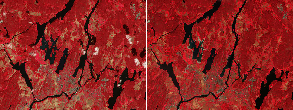
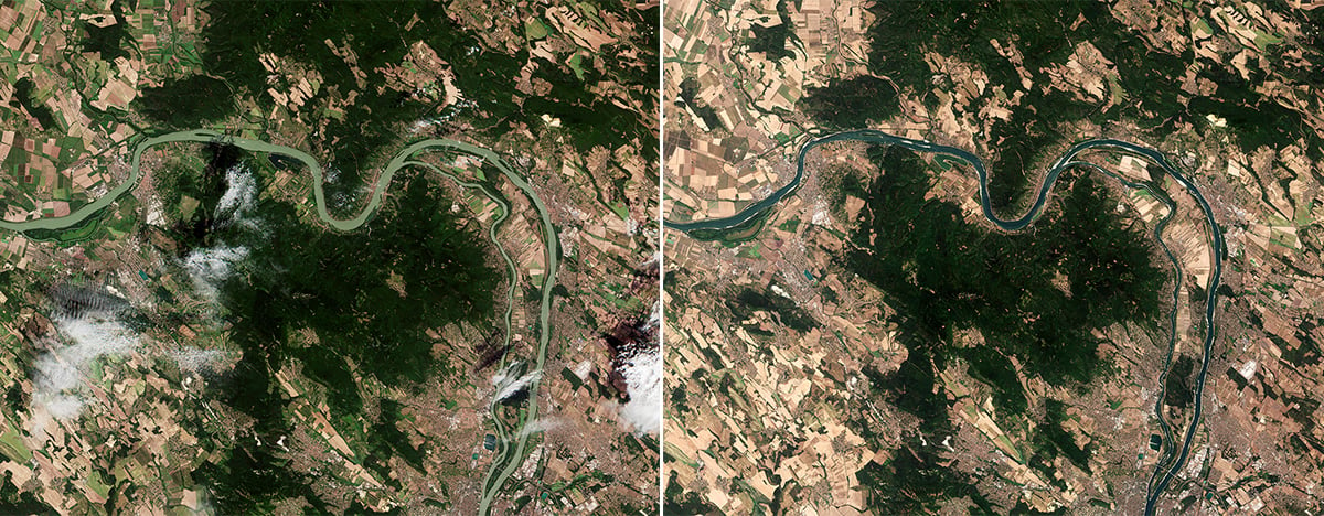
The mission is also useful during drought. Vegetation responds to a lack of water, and changes in its spectral signature can provide clues about environmental stress. Scientists can combine these observations with weather and soil data to build a clearer picture of conditions leading up to a fire.
Sentinel-5P: Photographing the heat and aerosol
Wildfires produce both gases and aerosols. Their concentrations can vary considerably depending on what is burning and how the fire behaves. Satellite measurements allow scientists to track these emissions over much larger areas than ground-based monitoring networks can cover.
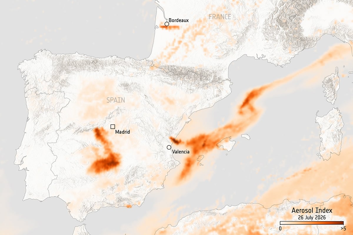
On 26 July, Sentinel-5P observations showed elevated aerosol concentrations associated with wildfires in France and Spain. The affected areas included Gironde in southwestern France, Ávila in Spain, and a region north of Valencia.
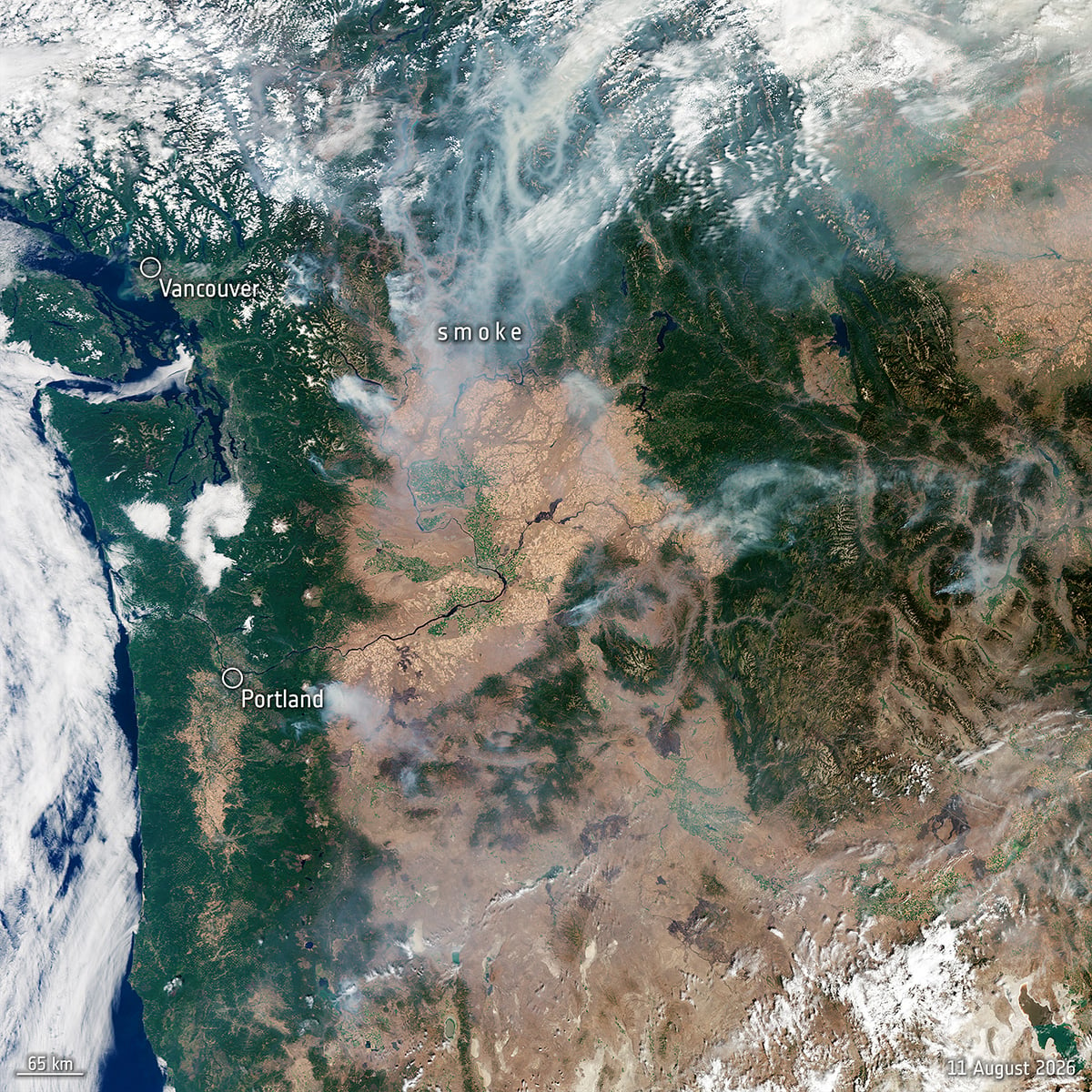
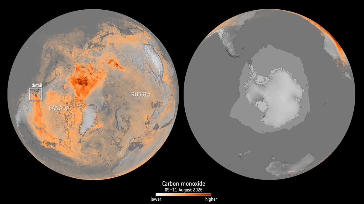
Carbon monoxide is another example. Sentinel-5P observations collected between 9 and 11 August showed elevated concentrations across Canada and other parts of the Northern Hemisphere. ESA linked these patterns to emissions from major wildfires in Canada and Siberia.
You can check the complete collection here.
Clear skies!
See more from DIYPhotography.net on Google
Add DIYPhotography.net as a trusted source. This makes
our stories more likely to appear in your Google Search results.
 Add as a preferred source on Google

Soumyadeep Mukherjee
Soumyadeep Mukherjee is an award-winning astrophotographer from India. He has a doctorate degree in Linguistics. His work extends to the sub-genres of nightscape, deep sky, solar, lunar and optical phenomenon photography. He is also a photography educator and has conducted numerous workshops. His works have appeared in over 40 books & magazines including Astronomy, BBC Sky at Night, Sky & Telescope among others, and in various websites including National Geographic, NASA, Forbes. He was the first Indian to win “Astronomy Photographer of the Year” award in a major category.
Related Posts
 Elon Musk plans to dim the Starlink satellites to reduce light pollution in the night sky
 ESA’s Mars Orbiter Capture “Closest Yet” View of Interstellar Comet 3I/ATLAS
 Eclipse on Demand: ESA creates Artificial Solar Eclipse in Space
 “Love from Above”: ESA’s Sentinel-2 Reveals Egypt’s Heart from Space
Join the Discussion
DIYP Comment Policy
Be nice, be on-topic, no personal information or flames.