























NASA Satellites Capture the Atacama Desert Turning Purple After Heavy Rains
Nov 21, 2026
Soumyadeep Mukherjee
Soumyadeep Mukherjee is an award-winning astrophotographer from India. He has a doctorate degree in Linguistics. His work extends to the sub-genres of nightscape, deep sky, solar, lunar and optical phenomenon photography. He is also a photography educator and has conducted numerous workshops. His works have appeared in over 40 books & magazines including Astronomy, BBC Sky at Night, Sky & Telescope among others, and in various websites including National Geographic, NASA, Forbes. He was the first Indian to win “Astronomy Photographer of the Year” award in a major category.
Share:
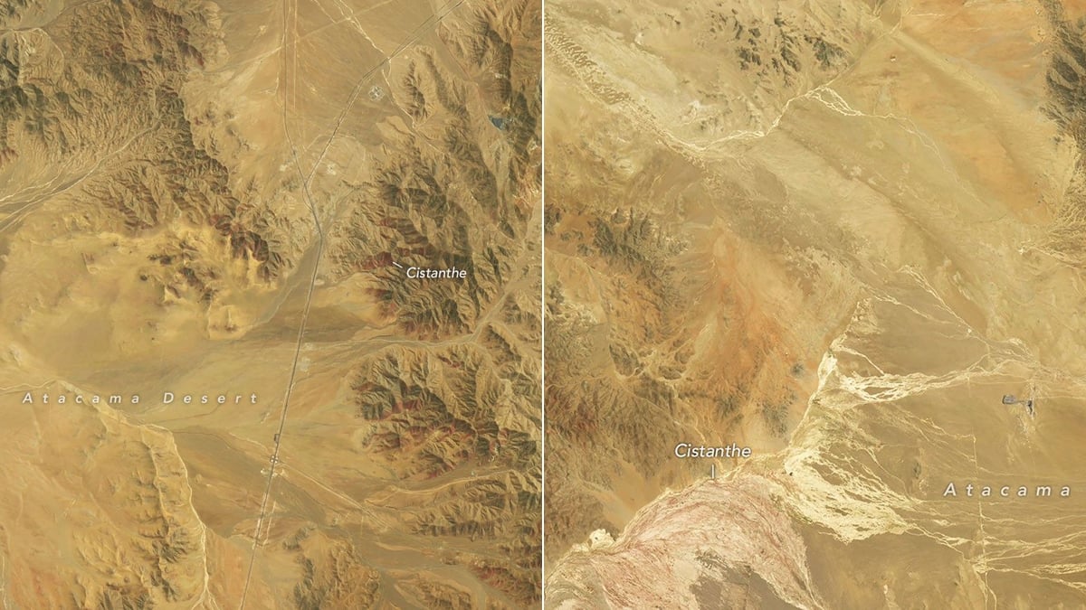
The Atacama Desert in northern Chile received an unusual amount of rain during the winter of 2026. By September, plants had begun growing across sections of the normally barren landscape. A month later, many hillsides displayed extensive patches of red, purple, and white flowers.
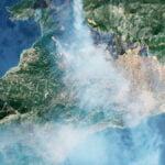
NASA’s Landsat satellites recorded the changes in a series of images taken several weeks apart. The photographs show how the desert responded to the additional moisture and how quickly its appearance changed.
A wet winter across the Atacama
In July, several storm systems brought unusually heavy rain to northern Chile. An atmospheric river supplied moisture to these systems, contributing to one of the heaviest July rainfall events in decades. According to Chile’s national weather service, Dirección Meteorológica de Chile, the storms affected a large stretch of the country. Their reach extended from the Atacama region southward to Los Lagos.
The rainfall continued into August, when successive winter storms brought rare snowfall to parts of the desert. This was unusual for a region where some locations receive only a few millimeters of rain each year. The extra moisture reached the soil and created the conditions dormant desert plants needed to begin growing. Many of these plants can survive long dry periods without producing visible vegetation. Their seeds remain in the soil until sufficient water becomes available.
Landsat 8 and 9 images capture the change
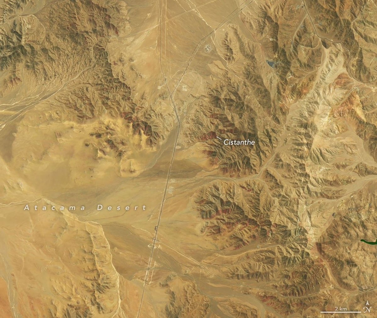
NASA used observations from Landsat 8 and Landsat 9 to document the flowering season. The first satellite image dates from September 14, 2026. Landsat 8 captured the scene using its Operational Land Imager (OLI). Landsat 9 recorded the same locations again on October 24. Both satellites carry OLI instruments, which measure reflected light across several spectral bands.
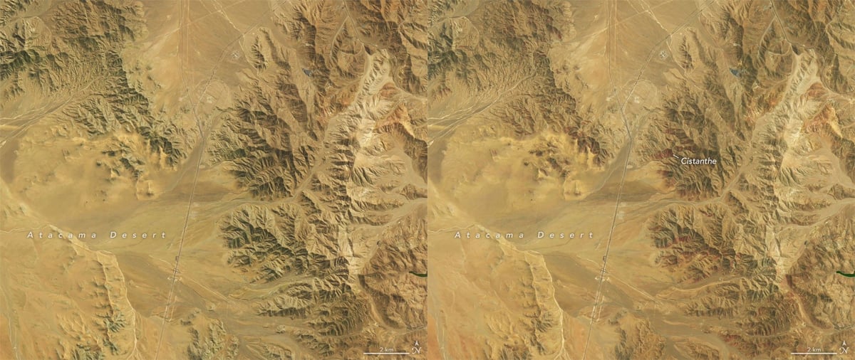
The first comparison covers an area approximately 30 kilometers southwest of Copiapó. It lies near the eastern section of Desierto Florido National Park. In the September image, brown terrain dominates the scene. Small green patches appear on some hillsides, but much of the landscape still looks dry. The October image shows a substantial difference. Red-purple patches now cover several hillsides, marking areas where flowering plants have grown.
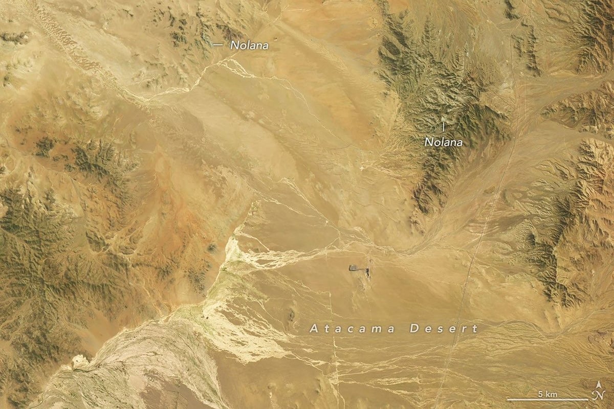
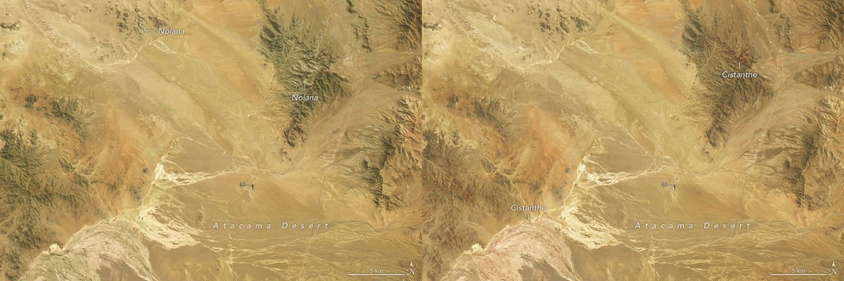
The second comparison comes from another location, approximately 50 kilometers southwest of Copiapó. This area lies within a region recognized for its biological significance. Its September image shows green hillsides with broad white patches. By October, much of the white flowering has disappeared, while red-purple patches have become more prominent. The two dates capture different stages of the same flowering season.
Cistanthe and Nolana produce the red and white flowers
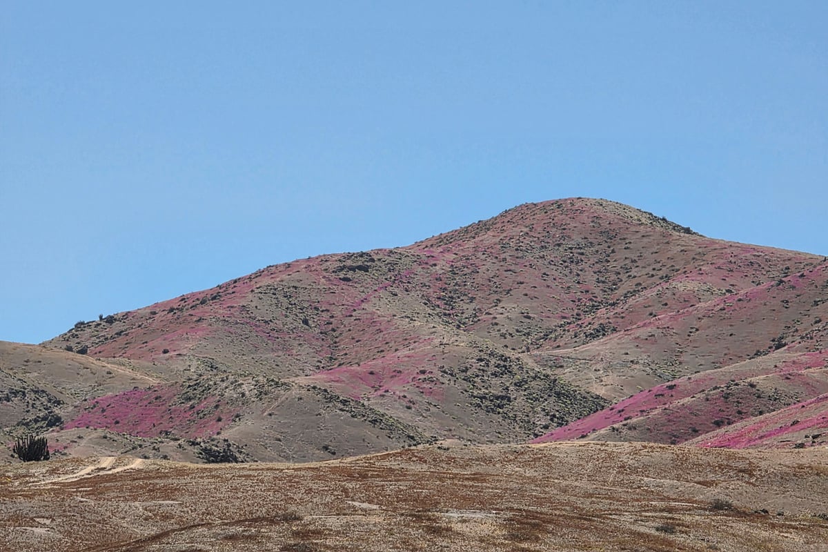
The colors in NASA’s satellite images come from native desert plants. Two groups are found in the observations. The first is known locally as pata de guanaco. Its red-purple flowers cover extensive sections of the landscape in the October images. Roberto Chávez, a remote sensing scientist at Pontificia Universidad Católica de Valparaíso, believes the flowers belong to Cistanthe longiscapa or another species within the Cistanthe genus.
Chávez and his colleagues photographed the flowering plants on October 24, the same day Landsat 9 captured its images. Their ground photographs show the plants growing across the hillsides. These photographs also help researchers interpret the satellite observations. From orbit, the flowers appear as colored patches. Ground-level images reveal the individual plants responsible for those patterns and help scientists check their identification.
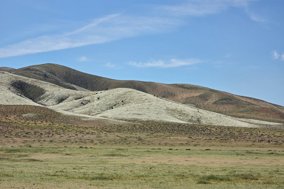
The September observations show another flowering group. The green hillsides covered with white flowers belong to plants known locally as suspiros, or Nolana. Andrés Moreira-Muñoz, a plant geography researcher at Pontificia Universidad Católica de Valparaíso, identified them as probably Nolana baccata.
Clear skies!
See more from DIYPhotography.net on Google
Add DIYPhotography.net as a trusted source. This makes
our stories more likely to appear in your Google Search results.
 Add as a preferred source on Google

Soumyadeep Mukherjee
Soumyadeep Mukherjee is an award-winning astrophotographer from India. He has a doctorate degree in Linguistics. His work extends to the sub-genres of nightscape, deep sky, solar, lunar and optical phenomenon photography. He is also a photography educator and has conducted numerous workshops. His works have appeared in over 40 books & magazines including Astronomy, BBC Sky at Night, Sky & Telescope among others, and in various websites including National Geographic, NASA, Forbes. He was the first Indian to win “Astronomy Photographer of the Year” award in a major category.



Join the Discussion
DIYP Comment Policy
Be nice, be on-topic, no personal information or flames.