

















NASA & ESA Satellites Capture Three Massive Cyclones from Space
Nov 4, 2026
Soumyadeep Mukherjee
Soumyadeep Mukherjee is an award-winning astrophotographer from India. He has a doctorate degree in Linguistics. His work extends to the sub-genres of nightscape, deep sky, solar, lunar and optical phenomenon photography. He is also a photography educator and has conducted numerous workshops. His works have appeared in over 40 books & magazines including Astronomy, BBC Sky at Night, Sky & Telescope among others, and in various websites including National Geographic, NASA, Forbes. He was the first Indian to win “Astronomy Photographer of the Year” award in a major category.
Share:
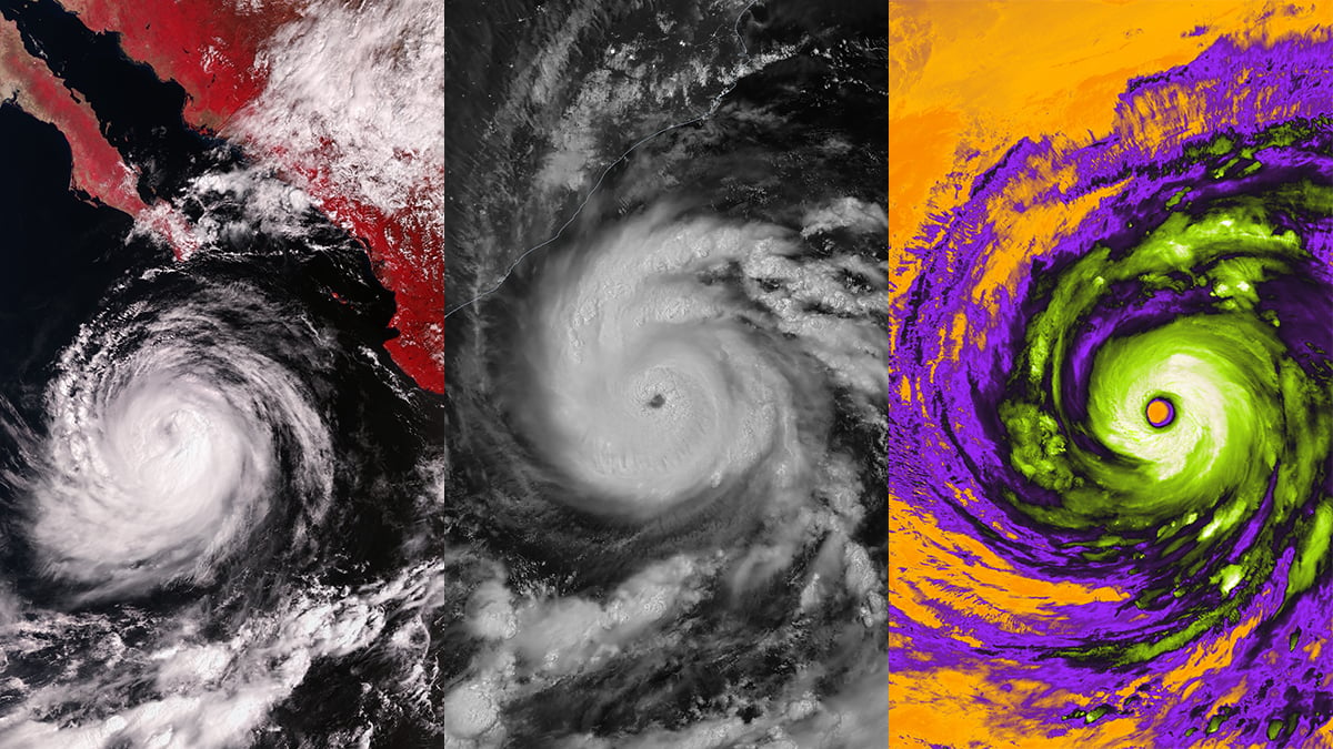
A tropical cyclone looks very different from space than it does from the ground. Its enormous cloud formations, spiral rainbands, and central eye become visible over vast stretches of ocean. Satellites also record details that human eyes cannot see, including temperatures at the tops of thunderstorms and faint light reflected from clouds at night.
Three satellite images offer an interesting look at three of the recent massive cyclones around the world. ESA satellites captured images of Hurricane Rachel and Super Typhoon Champi, and NASA‘s Earth Observatory shared a nighttime view of Cyclone Arnab approaching India’s eastern coast.
Hurricane Rachel over the Pacific
On October 2, the European Space Agency’s newest Sentinel-3C satellite turned its attention towards Hurricane Rachel over the eastern Pacific Ocean. The storm was located off the coast of Mexico and the Baja California Peninsula.
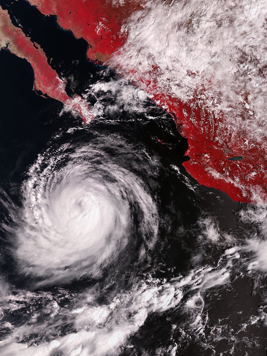
The photograph uses the instrument’s visible channels. It is a false-color image, with vegetation appearing red and the storm’s extensive cloud formations standing out against the surrounding ocean. These colors help distinguish different features across the scene. They do not represent the natural colors that a person would see from space.
The visible channels also serve an important role in the instrument’s temperature measurements. They help identify clouds that could interfere with Earth-surface observations. Scientists use these measurements to improve atmospheric corrections and distinguish clear areas from cloud-covered regions.
Cyclone Arnab in the middle of the night
While Sentinel-3C photographed Rachel during daylight, NASA’s image of Cyclone Arnab came from an observation made in the early hours of the morning. NOAA-20 captured the storm over the Bay of Bengal at 20:12 UTC on October 26.
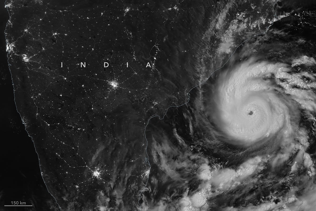
Arnab was the first named storm of the 2026 North Indian Ocean cyclone season. It had sustained winds of approximately 140 kilometers per hour when the satellite recorded the image. The storm later made landfall along the Andhra Pradesh and Yanam coast on October 28.
The image came from the Visible Infrared Imaging Radiometer Suite, commonly known as VIIRS. The instrument flies aboard NOAA-20 and collects observations across several visible and infrared spectral bands. It monitors clouds, oceans, vegetation, fires, and other features across the planet. One of its most interesting capabilities comes from its Day/Night Band.
An infrared image of Super Typhoon Champi
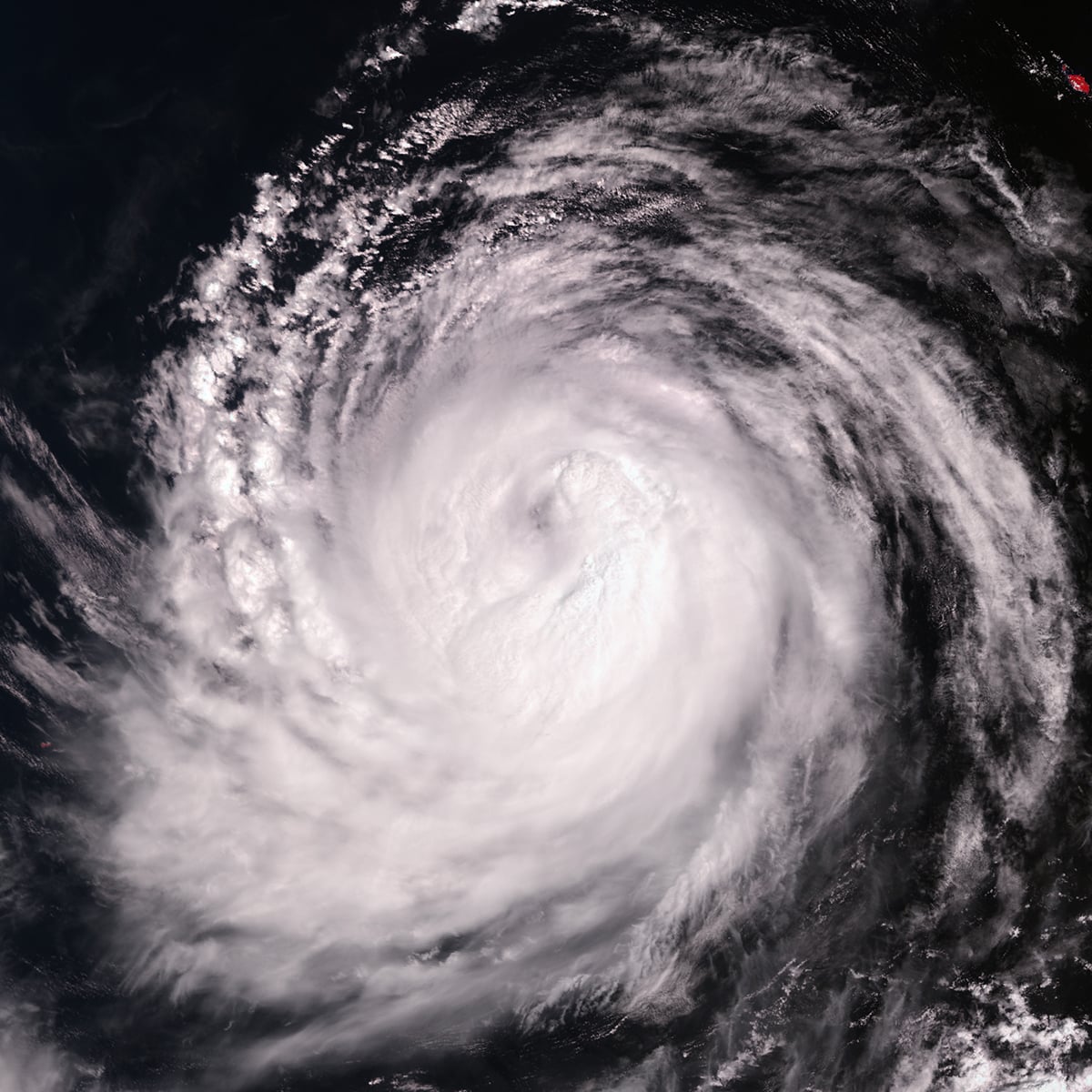
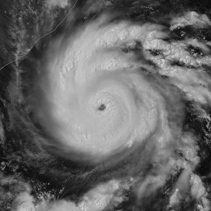
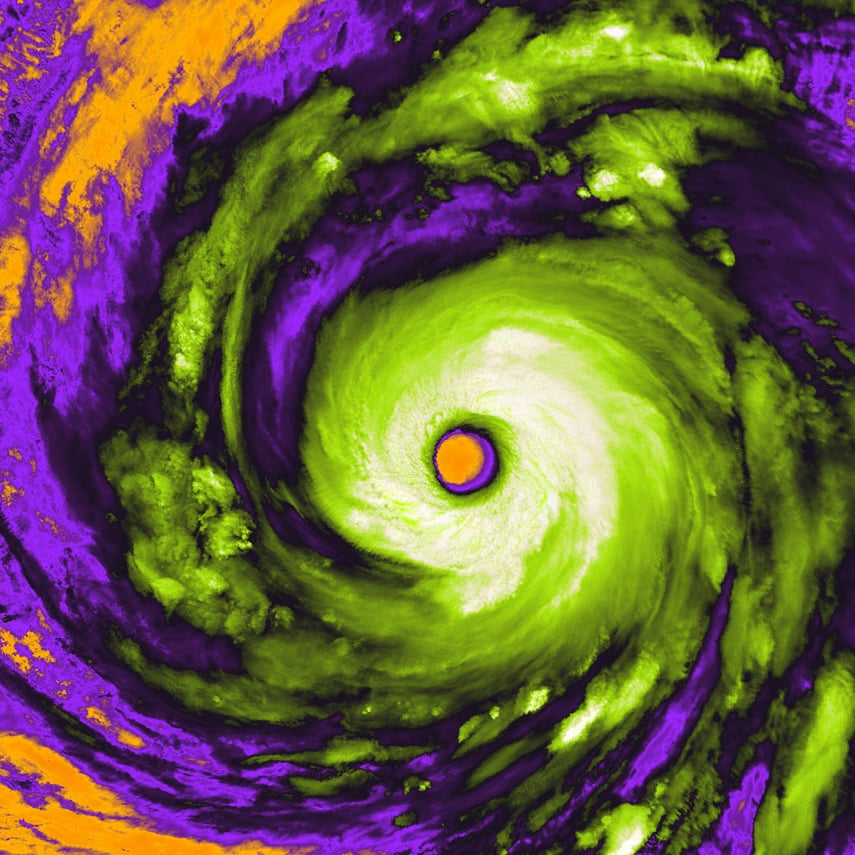
The third photograph takes us to the western Pacific, where Super Typhoon Champi developed a well-defined eye surrounded by enormous cloud formations. Sentinel-3 captured the image on October 21, off the coasts of Taiwan and the Philippines.
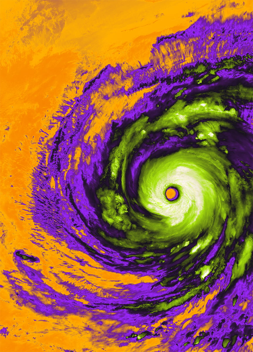
Champi’s eye measures approximately 50 kilometers across. The storm had maximum sustained winds of 296 kilometers per hour, making it the strongest tropical cyclone recorded so far in 2026, according to ESA.
The image was captured by SLSTR, the same instrument family that photographed Hurricane Rachel. This time, however, scientists used thermal infrared measurements and not visible-light observations. The instrument detected radiation from the tops of Champi’s clouds, the ocean, and part of the surrounding land.
Clear skies!
See more from DIYPhotography.net on Google
Add DIYPhotography.net as a trusted source. This makes
our stories more likely to appear in your Google Search results.
 Add as a preferred source on Google

Soumyadeep Mukherjee
Soumyadeep Mukherjee is an award-winning astrophotographer from India. He has a doctorate degree in Linguistics. His work extends to the sub-genres of nightscape, deep sky, solar, lunar and optical phenomenon photography. He is also a photography educator and has conducted numerous workshops. His works have appeared in over 40 books & magazines including Astronomy, BBC Sky at Night, Sky & Telescope among others, and in various websites including National Geographic, NASA, Forbes. He was the first Indian to win “Astronomy Photographer of the Year” award in a major category.

Join the Discussion
DIYP Comment Policy
Be nice, be on-topic, no personal information or flames.