



















ESA’s New Weather Satellite Photographs Earth Every 2.5 Minutes
Nov 11, 2026
Soumyadeep Mukherjee
Soumyadeep Mukherjee is an award-winning astrophotographer from India. He has a doctorate degree in Linguistics. His work extends to the sub-genres of nightscape, deep sky, solar, lunar and optical phenomenon photography. He is also a photography educator and has conducted numerous workshops. His works have appeared in over 40 books & magazines including Astronomy, BBC Sky at Night, Sky & Telescope among others, and in various websites including National Geographic, NASA, Forbes. He was the first Indian to win “Astronomy Photographer of the Year” award in a major category.
Share:
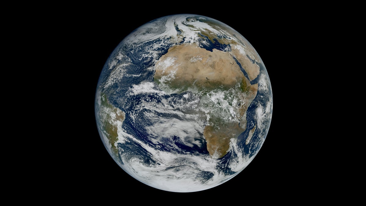
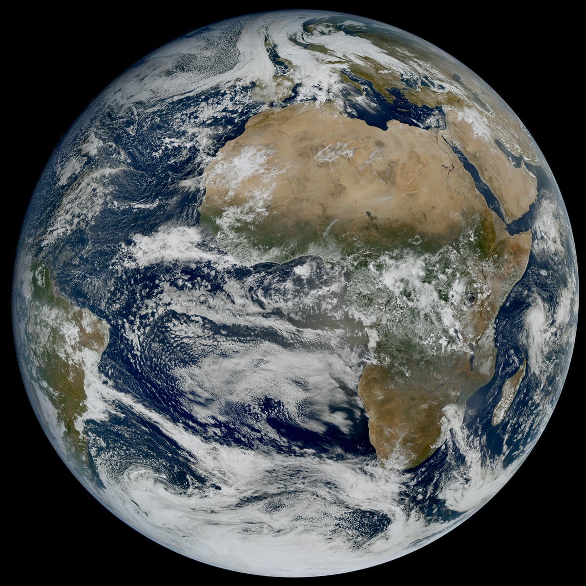
The European Space Agency (ESA) has released the first images from its Meteosat Third Generation Imager-2 (MTG-I2) satellite. An animation combines 45 hours of observations, beginning on 3 November 2026. Each frame comes from an observation taken just 150 seconds after the previous one. The footage follows several weather systems across Europe, the Mediterranean and the Atlantic.
The sequence shows low clouds and fog lingering over central Europe. Large convective clouds develop over the Mediterranean, while clouds at different altitudes move in opposite directions over the Atlantic. A plume of smoke from a wildfire in central Portugal also appears in the footage.
45 hours of weather activity in one video
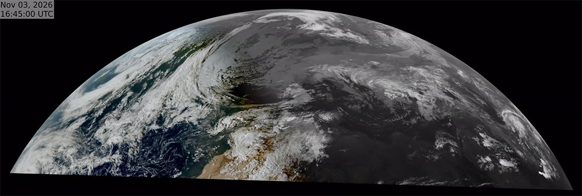
The animation begins on 3 November and follows weather conditions across Europe and North Africa for 45 hours. The Central European region shows extensive low clouds and fog. These formations remain visible through successive frames, allowing viewers to follow their movement and changes in coverage.
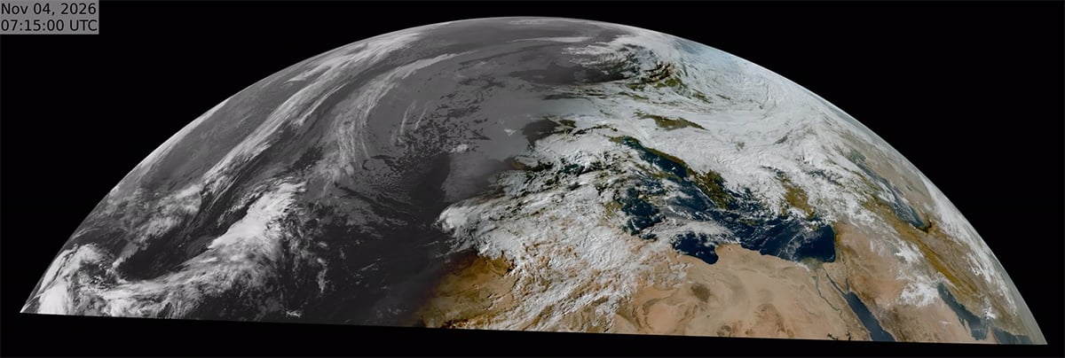
Over the Mediterranean, the satellite follows the development of deep convective clouds. These formations grow when warm, moist air rises through the atmosphere. As the air cools, water vapor condenses and forms clouds. Strong convection can produce towering storm clouds, heavy rainfall, and thunderstorms.
The wildfire smoke over central Portugal adds an environmental dimension to the footage. Smoke can travel far beyond the fire itself, carried by winds through different layers of the atmosphere. Its movement can affect air quality and visibility over distant areas.
The imaging technology behind MTG-I2
MTG-I2 carries two imaging instruments. Its main instrument, the Flexible Combined Imager (FCI), observes clouds, atmospheric moisture and other features across several wavelengths. The second instrument, called the Lightning Imager, detects lightning flashes over a large part of Earth’s visible disc.
The FCI observes Earth through 16 spectral channels. These cover wavelengths from visible light to infrared radiation, between 0.3 and 13.3 micrometers. Each channel records a different part of the radiation reaching the instrument. Meteorologists can combine the measurements to examine clouds, water vapor, dust, smoke, and other atmospheric features.
The instrument also has two main scanning modes. In full-disc mode, the FCI scans the entire visible Earth disc every 10 minutes. Its rapid scanning mode concentrates on the upper quarter of the disc, covering Europe and North Africa. This mode produces a fresh observation every 2.5 minutes.
The satellite watches Earth from 36,000 kilometers away
MTG-I2 operates in geostationary orbit, approximately 36,000 kilometers above Earth‘s surface. At this altitude, the satellite completes one orbit in about 24 hours. Its orbital period matches Earth’s rotation, so it appears to remain above the same geographical region.
This position allows the satellite to monitor Europe continuously. It does not have to wait until another orbit brings it over the same location. Instead, it repeatedly scans its assigned region and sends observations to ground stations. Meteorologists can compare successive images and follow changes throughout the day.
The satellite‘s distance from Earth also places demand on its imaging instruments. The FCI must observe a vast area while detecting relatively small atmospheric features. Its multiple spectral channels help distinguish different types of clouds and other phenomena. Its scanning system also allows it to balance broad coverage with frequent regional observations.
Clear skies!
See more from DIYPhotography.net on Google
Add DIYPhotography.net as a trusted source. This makes
our stories more likely to appear in your Google Search results.
 Add as a preferred source on Google

Soumyadeep Mukherjee
Soumyadeep Mukherjee is an award-winning astrophotographer from India. He has a doctorate degree in Linguistics. His work extends to the sub-genres of nightscape, deep sky, solar, lunar and optical phenomenon photography. He is also a photography educator and has conducted numerous workshops. His works have appeared in over 40 books & magazines including Astronomy, BBC Sky at Night, Sky & Telescope among others, and in various websites including National Geographic, NASA, Forbes. He was the first Indian to win “Astronomy Photographer of the Year” award in a major category.
Related Posts
 2020 Weather Photographer of the Year winners prove that you can take stunning photos in any weather
 NASA’s new satellite offers stunningly high resolution images of earth
 This project puts you in charge of a satellite to let you take photos of Earth
 ESA’s Sentinel-3C Satellite Reveals Its First Images of Earth
Join the Discussion
DIYP Comment Policy
Be nice, be on-topic, no personal information or flames.