
















ESA’s Satellite Images Reveal the Hidden Details of Mongolia and the Amazon
Nov 13, 2026
Soumyadeep Mukherjee
Soumyadeep Mukherjee is an award-winning astrophotographer from India. He has a doctorate degree in Linguistics. His work extends to the sub-genres of nightscape, deep sky, solar, lunar and optical phenomenon photography. He is also a photography educator and has conducted numerous workshops. His works have appeared in over 40 books & magazines including Astronomy, BBC Sky at Night, Sky & Telescope among others, and in various websites including National Geographic, NASA, Forbes. He was the first Indian to win “Astronomy Photographer of the Year” award in a major category.
Share:
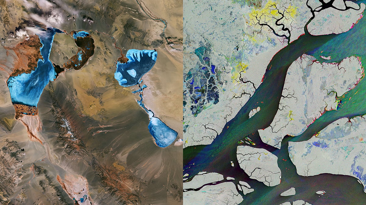
The Great Lakes Depression in western Mongolia and the Amazon Delta in Brazil look very different from space. One contains lakes surrounded by dry steppe and mountains. The other has an extensive network of rivers, forests, and mangroves. Yet two recent images from the European Space Agency (ESA) reveal something interesting about both landscapes. They show features and changes that conventional photography cannot easily capture.
ESA has published the images through its Earth from Space series. The first comes from the Copernicus Sentinel-2 satellite and shows three lakes in Mongolia. The second uses observations from Sentinel-1 to examine Macapá and the surrounding Amazon Delta. Although both spacecraft observe Earth’s surface, they use different instruments to collect their data.
Sentinel-2: Three lakes in Mongolia’s Great Lakes Depression
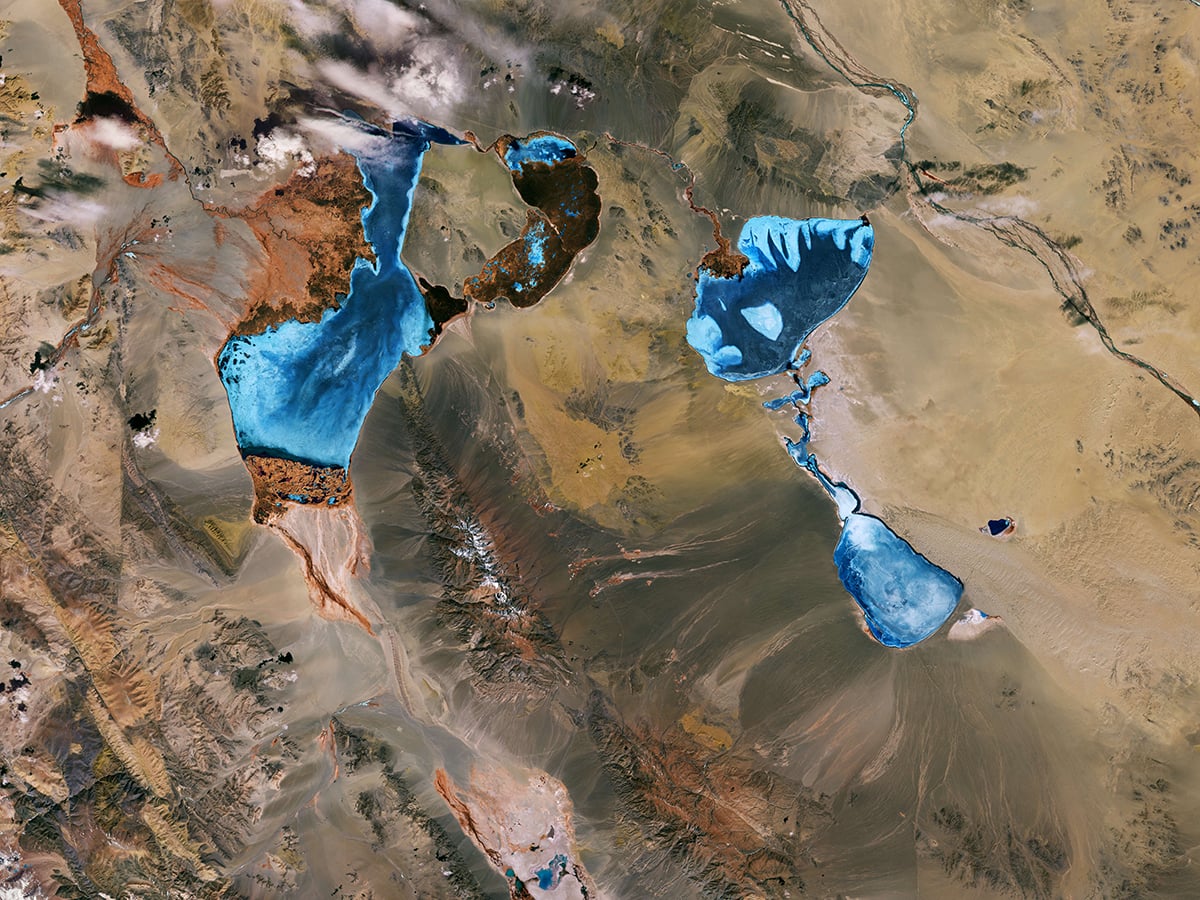
For this image, Sentinel-2 collected the observations on 11 April 2026, over Khovd Province in western Mongolia. The image shows three lakes: Khar-Us, Khar, and Durgun. Khar-Us occupies the left side, Khar lies to its right, and Durgun appears further south, connected to Khar.
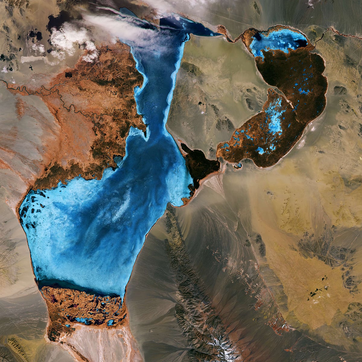
These lakes belong to the Great Lakes Depression, a large geographical region that contains remnants of a prehistoric lake. The surrounding landscape is mostly dry steppe, but the lakes support a variety of ecosystems. The wider region forms an extensive Biosphere Reserve and provides habitats for rare and endangered species. Migratory wildlife also uses the area as a seasonal stopover.
A snow-covered mountain stands out near Khar-Us Lake. Jargalant Hayrhan rises 3,796 meters above sea level. Its Mongolian name translates as ‘holy blissful mountain’. The mountain interrupts the relatively flat surrounding terrain and provides a prominent landmark in the image.
Sentinel-1: Changes around Macapá and the Amazon Delta
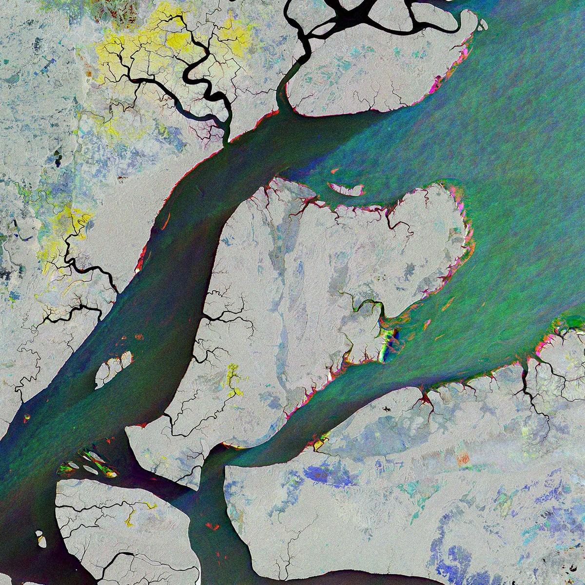
The second image takes us to northern Brazil. It shows the mouth of the Amazon Delta and the city of Macapá, the capital of Amapá state. The city sits on the equator, surrounded by the Amazon rainforest, mangroves, and an extensive network of rivers.
Unlike the Mongolia image, this view does not need reflected sunlight. Sentinel-1 uses synthetic aperture radar (SAR) to observe Earth’s surface. ESA has combined three radar acquisitions from the second half of 2026 to create the composite. Each acquisition contributes a different color, allowing viewers to identify where the landscape changed between observations.
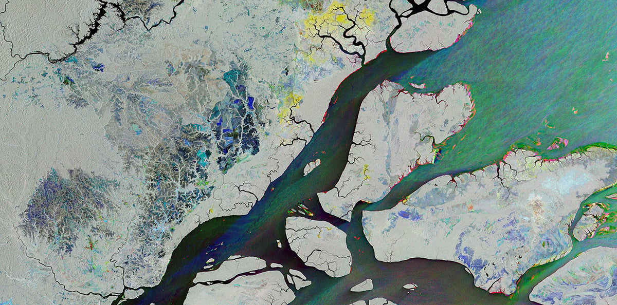
The blue areas represent changes detected on 15 August. Green marks changes recorded on 20 September, while red indicates differences observed on 26 October. Areas that changed very little appear grey, white or black. The coloured patterns can result from several processes, including vegetation growth, changing riverbanks, variations in sea conditions and land subsidence.
Two satellites, two different techniques
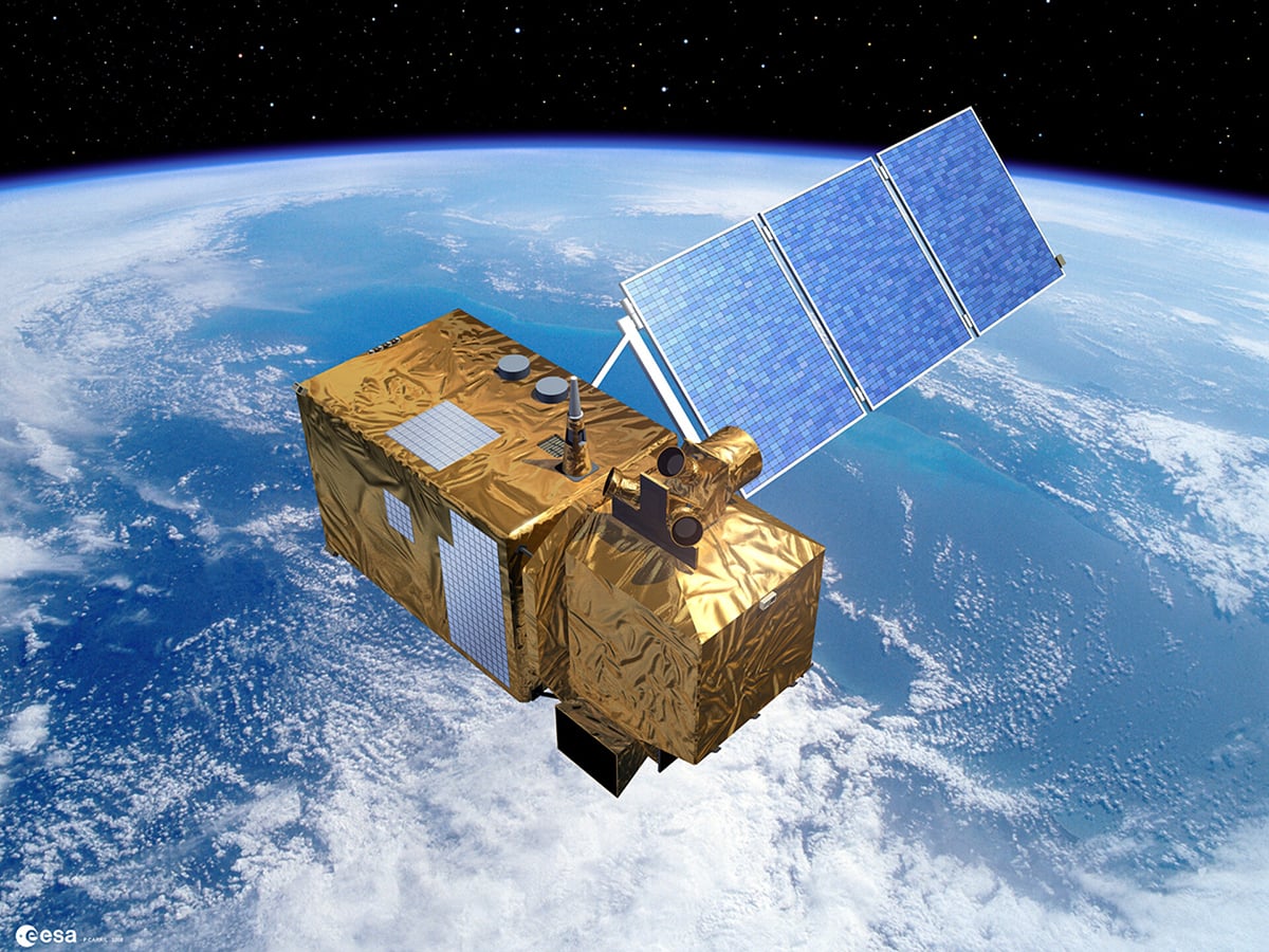
The Sentinel-2 satellite carries a Multi-Spectral Instrument that records reflected energy across 13 spectral bands. These bands cover visible light, near-infrared, and shortwave infrared wavelengths. The instrument measures how different materials respond to these wavelengths. Scientists then combine selected measurements to produce images that highlight particular surface features.
Sentinel-2’s multispectral observations have several applications. Researchers use them to study vegetation, agricultural land, water resources, and changes in land cover.
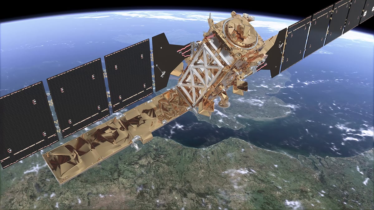
Sentinel-1’s Macapá image uses a technique that differs considerably from conventional photography. A camera records light reflected or emitted by objects. Sentinel-1 sends microwave pulses towards the ground and measures the signals that return to its instrument. This makes it an active imaging system.
Sentinel-1 uses C-band radar at approximately 5.405 GHz. Its synthetic aperture technique helps produce detailed images from orbit. As the satellite moves along its path, its instrument collects multiple measurements of the same area.
Clear skies!
See more from DIYPhotography.net on Google
Add DIYPhotography.net as a trusted source. This makes
our stories more likely to appear in your Google Search results.
 Add as a preferred source on Google

Soumyadeep Mukherjee
Soumyadeep Mukherjee is an award-winning astrophotographer from India. He has a doctorate degree in Linguistics. His work extends to the sub-genres of nightscape, deep sky, solar, lunar and optical phenomenon photography. He is also a photography educator and has conducted numerous workshops. His works have appeared in over 40 books & magazines including Astronomy, BBC Sky at Night, Sky & Telescope among others, and in various websites including National Geographic, NASA, Forbes. He was the first Indian to win “Astronomy Photographer of the Year” award in a major category.


Join the Discussion
DIYP Comment Policy
Be nice, be on-topic, no personal information or flames.