









NASA-IBM’s New Lunar Foundation Model: AI to Study Lunar Images
Sep 12, 2026
Soumyadeep Mukherjee
Soumyadeep Mukherjee is an award-winning astrophotographer from India. He has a doctorate degree in Linguistics. His work extends to the sub-genres of nightscape, deep sky, solar, lunar and optical phenomenon photography. He is also a photography educator and has conducted numerous workshops. His works have appeared in over 40 books & magazines including Astronomy, BBC Sky at Night, Sky & Telescope among others, and in various websites including National Geographic, NASA, Forbes. He was the first Indian to win “Astronomy Photographer of the Year” award in a major category.
Share:
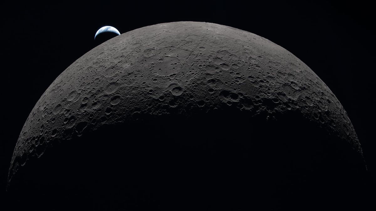
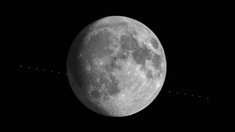
For 17 years, NASA‘s Lunar Reconnaissance Orbiter has been photographing the Moon from above. It has recorded craters, lava plains, boulders, ridges, and the permanently shadowed floors of polar craters. The spacecraft has built an extraordinarily detailed record of the lunar surface. And over the years, it has generated too much data for scientists to examine by hand.
NASA and IBM have turned to artificial intelligence to tackle this. Their new NASA-IBM Lunar Foundation Model can search through large amounts of lunar imagery and other scientific measurements, giving researchers a new way to study the Moon’s surface. The model draws mainly on observations from the Lunar Reconnaissance Orbiter, or LRO.
Training the model: Seventeen years of LRO observations
The Lunar Reconnaissance Orbiter reached the Moon in 2009. Since then, it has watched the surface through several instruments, recording details that earlier lunar missions could never resolve. Its images show the Moon at metre-scale resolution in many areas. They reveal small craters, boulders, exposed rock, and subtle changes in the terrain.
NASA and IBM used roughly two million image tiles from LRO to train the Lunar Foundation Model. More than one million came from high-resolution camera observations at about one meter per pixel. Nearly 964,000 came from multispectral images at about 100 meters per pixel.
“NASA has spent decades building an extraordinary scientific record of the Moon, but collecting data is only part of the job. We also have to make data easier for scientists to explore and use. The NASA-IBM Lunar Foundation Model shows what’s possible when we bring AI to NASA’s petabytes of scientific data.”
-Kevin Murphy, NASA Chief Science Data Officer and Acting Chief Data Officer/Chief AI Officer
The researchers also brought in observations from NASA’s GRAIL and Lunar Prospector missions and Japan’s SELENE spacecraft. IBM and NASA say their new machine-learning dataset brings together more than 30 spatially aligned data layers from nine instruments across four missions.
It can search the Moon for impact craters
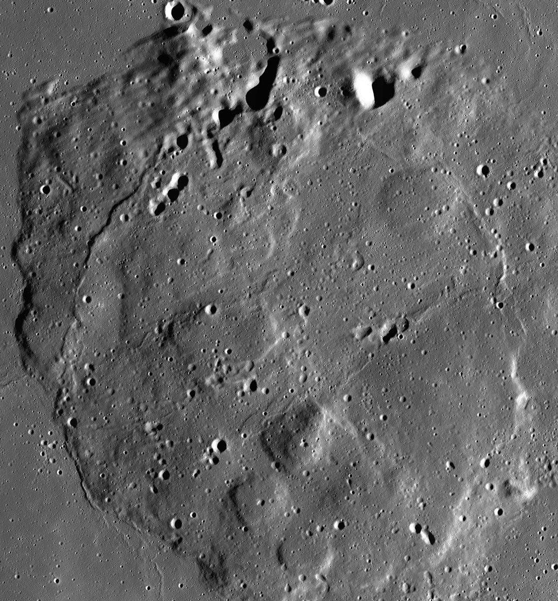
Impact craters are among the most useful features on the lunar surface. Every one records a collision, and the distribution of craters helps scientists work out how old different parts of the Moon may be.
Scientists have already catalogued more than two million large craters. Many smaller ones remain to be mapped, particularly in areas where future missions could need detailed terrain information. Crater maps also help researchers understand the geological history of different regions and can support the selection of potential landing sites.
The Lunar Foundation Model can search for these features across large areas of imagery. Researchers can then examine its results rather than beginning the search from an empty map.
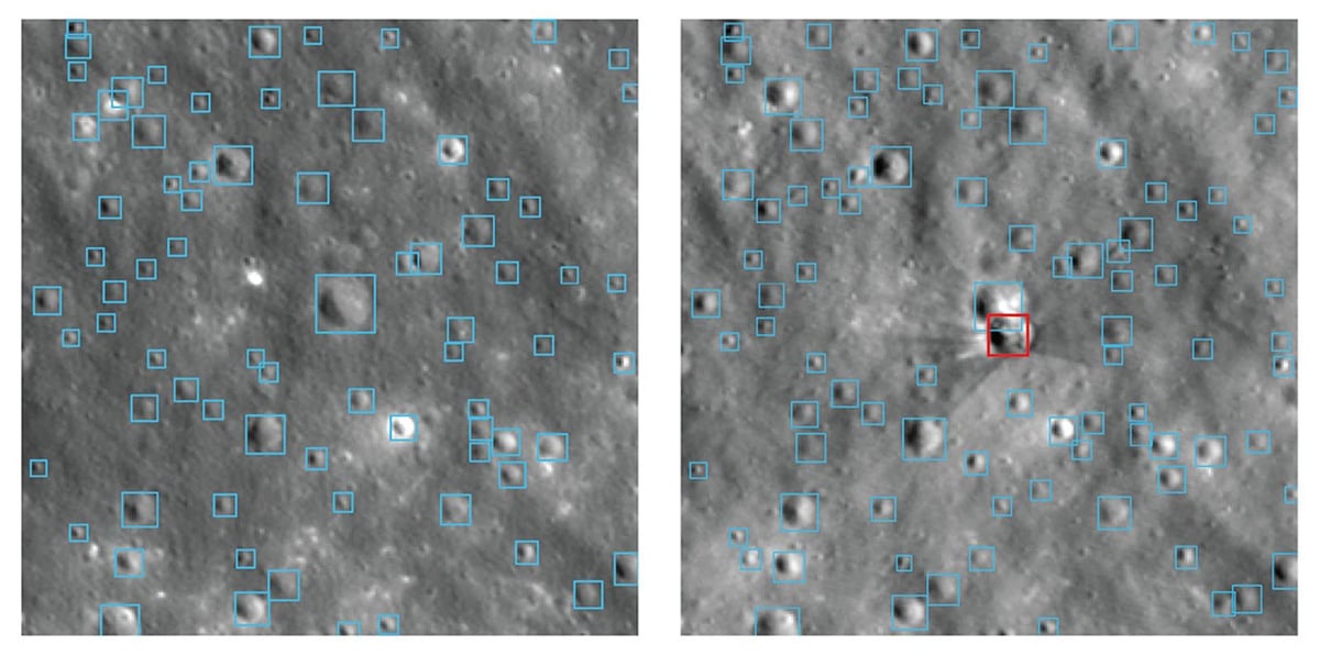
NASA has tested the system on a particularly useful example. A SpaceX rocket body struck the Moon near Einstein Crater, leaving a fresh impact crater. LRO photographed the area before and after the collision. The researchers did not include the post-impact image in the model’s original training. They later fine-tuned the model and asked it to identify the new feature. It found the fresh crater and also identified older craters in the surrounding terrain.
Finding young lunar volcanoes and lunar ice
The Moon’s surface also contains evidence of its volcanic past. These small volcanic features appear relatively young compared with many other lunar volcanic deposits. Their apparent age has raised questions about how long volcanic activity continued inside the Moon.
That is another job for which the new model could save considerable time. Researchers can use known examples to train the system to recognise similar structures elsewhere. The model can then search broad areas of lunar imagery and identify potential candidates.
On the other extreme, some craters near the poles never receive sunlight on their floors. These permanently shadowed regions can remain extremely cold, allowing water ice to survive for very long periods. Scientists have found evidence of water in several forms on the Moon. Among them, the polar ice has been particularly interesting.
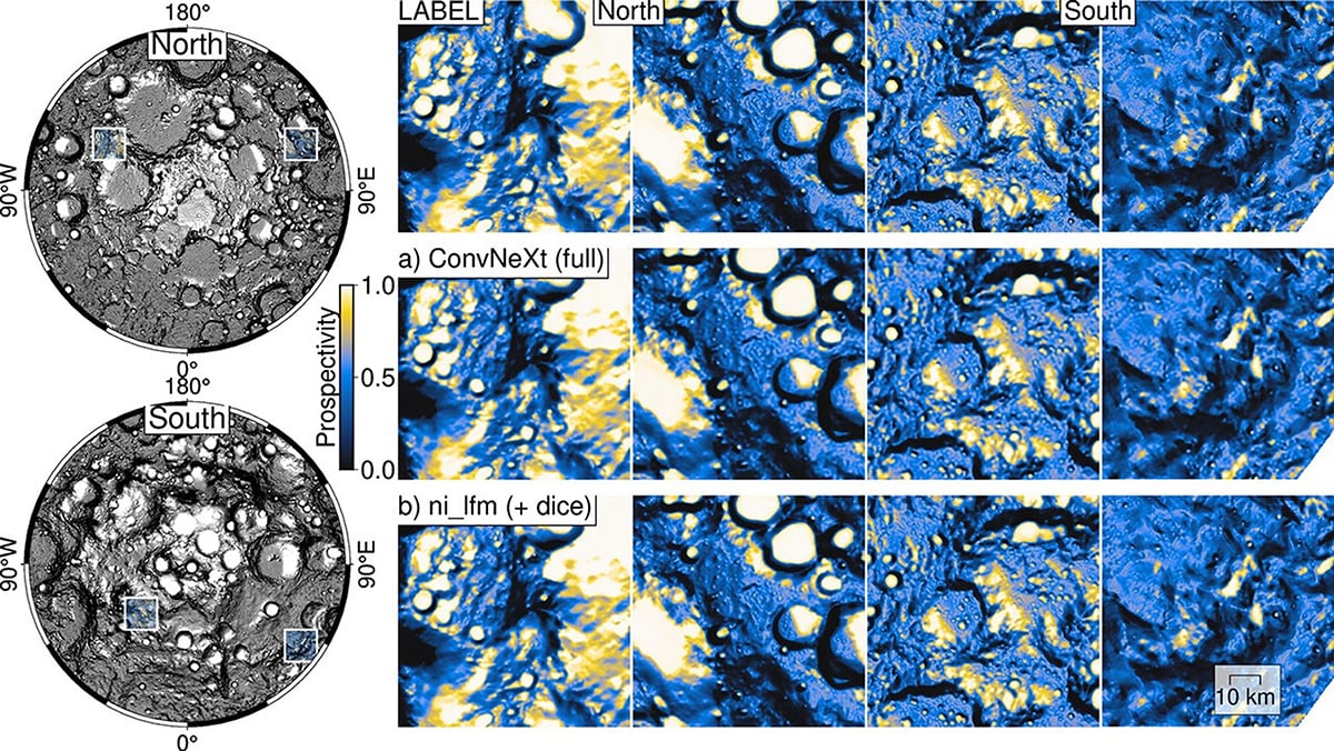
The Lunar Foundation Model can help with that search. It will combine different types of lunar observations to estimate ice prospectivity, including information about conditions on and below the surface. NASA says the model preserved fine details in ice-prospectivity maps and performed better than several comparison models on this task.
Clear skies!
See more from DIYPhotography.net on Google
Add DIYPhotography.net as a trusted source. This makes
our stories more likely to appear in your Google Search results.
 Add as a preferred source on Google

Soumyadeep Mukherjee
Soumyadeep Mukherjee is an award-winning astrophotographer from India. He has a doctorate degree in Linguistics. His work extends to the sub-genres of nightscape, deep sky, solar, lunar and optical phenomenon photography. He is also a photography educator and has conducted numerous workshops. His works have appeared in over 40 books & magazines including Astronomy, BBC Sky at Night, Sky & Telescope among others, and in various websites including National Geographic, NASA, Forbes. He was the first Indian to win “Astronomy Photographer of the Year” award in a major category.

Join the Discussion
DIYP Comment Policy
Be nice, be on-topic, no personal information or flames.