
















ESA Satellites Capture Two Lagoons in Completely Different Colors
Oct 3, 2026
Soumyadeep Mukherjee
Soumyadeep Mukherjee is an award-winning astrophotographer from India. He has a doctorate degree in Linguistics. His work extends to the sub-genres of nightscape, deep sky, solar, lunar and optical phenomenon photography. He is also a photography educator and has conducted numerous workshops. His works have appeared in over 40 books & magazines including Astronomy, BBC Sky at Night, Sky & Telescope among others, and in various websites including National Geographic, NASA, Forbes. He was the first Indian to win “Astronomy Photographer of the Year” award in a major category.
Share:
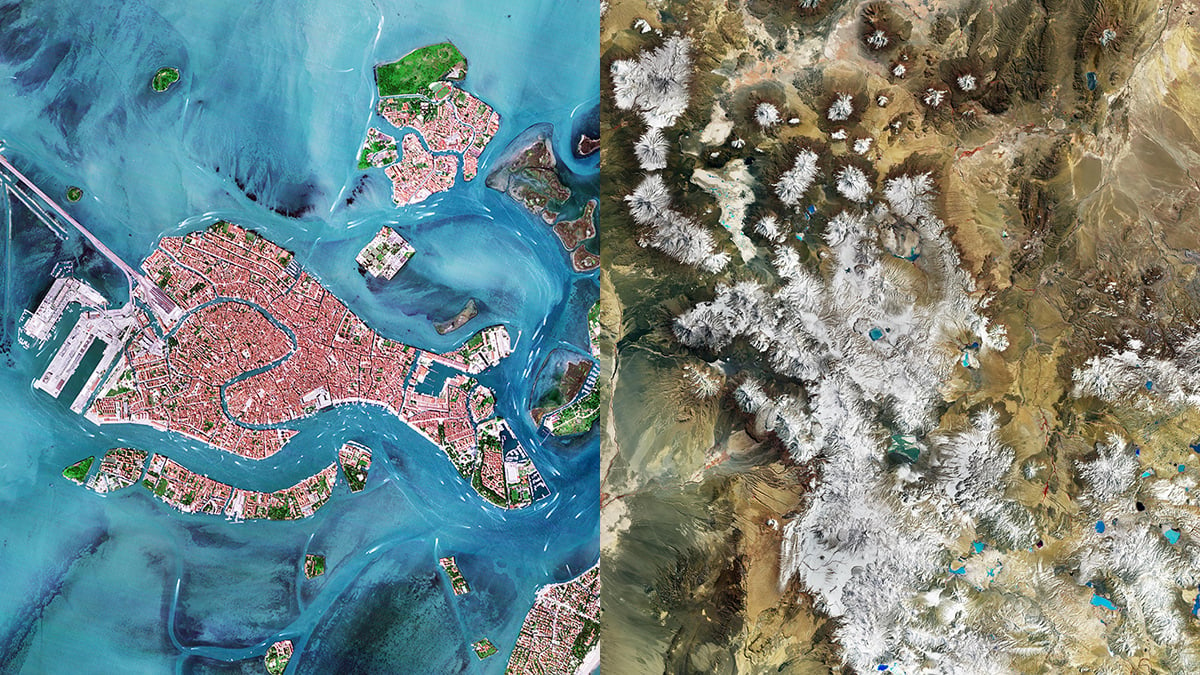
Two satellite images released by the European Space Agency (ESA) give us an idea of how different Earth can look from space. One of the images shows Venice and the Venetian Lagoon in familiar colors, with blue water, islands, and densely built-up areas. The other image shows Laguna Colorada in Bolivia, a lake famous for its red water, appearing blue and brown in the satellite image.
The difference in the images comes from the cameras that captured them and the wavelengths of light they recorded. The Venice image came from an Italian Earth-observation satellite that records in visible light, while the Laguna Colorada image came from the Copernicus Sentinel-2 mission that records near-infrared wavelengths.
A very familiar satellite photograph
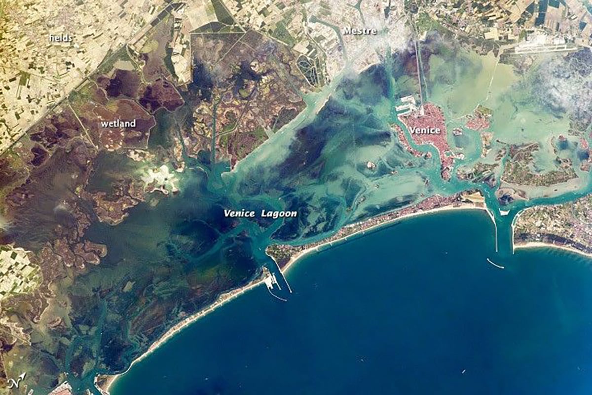
The Venetian Lagoon image looks familiar because its colors stay close to the visible-light view that we associate with aerial photography. Venice sits in the middle of the scene, surrounded by the shallow waters of the lagoon, with the mainland stretching away to the north and west.
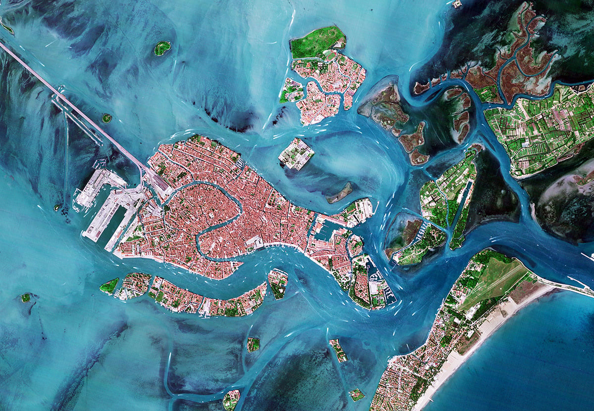
One can pick out several recognizable parts of the city and its surroundings. That includes the railway bridge linking Venice with the mainland crosses the lagoon for about 3.8 kilometers. One can also recognize that the port occupies a large area to the west, while Giudecca Island lies immediately south of the historic center.
The lagoon does not have one uniform shade of blue. Some shallow areas appear much lighter, while deeper and clearer water looks darker. ESA explains that suspended sediment contributes to the brighter colors in parts of the lagoon. The Adriatic Sea, visible near Venice Lido, appears darker than much of the shallow lagoon.
A famous Red Lagoon appears blue
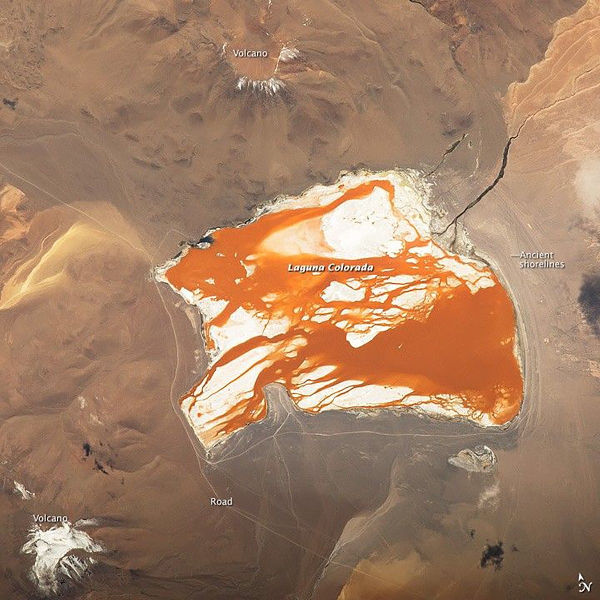
Laguna Colorada sits at about 4,278 meters above sea level in southwestern Bolivia. The lake forms part of the high Andean landscape near the Chilean border, where volcanoes, mountains, salt flats, and other lagoons surround it. The region reaches elevations above 4,000 meters, making it one of the highest landscapes shown in the ESA image.
The lake’s name comes from its appearance. Laguna Colorada means “Red Lagoon”, and the water can take on a strong reddish color when viewed from the ground. ESA attributes that appearance to the lake’s saline conditions and microorganisms living in its water. Seasonal changes can also affect the color’s intensity.
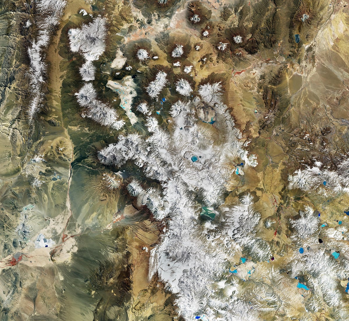
In the image, however, the lake appears blue and brown. At the same time, patches of vegetation elsewhere in the scene appear red. The image is a false-color composite. ESA has used Sentinel-2’s near-infrared data when producing the image. Near-infrared radiation lies beyond the range visible to human eyes, so we cannot see it as a separate color when looking at the landscape ourselves.
The cameras behind the images
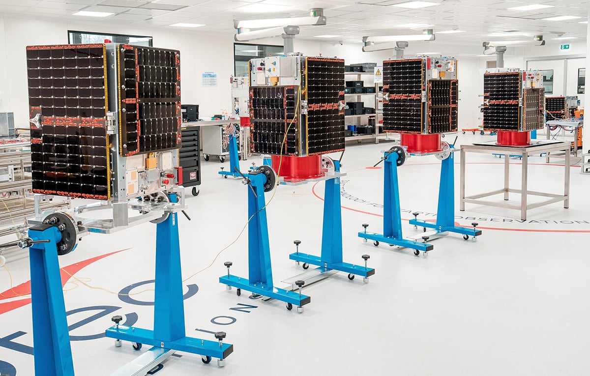
The satellite responsible for the Venetian Lagoon image belongs to IRIDE, Italy’s national Earth-observation programme. ESA developed the programme with the Italian Space Agency, bringing several satellite constellations together to collect different kinds of information about Italy and its surroundings.
HEO uses multispectral optical instruments with a spatial resolution of 2.7 meters. In practical terms, each pixel represents a patch of ground measuring only a few meters across. This level of detail makes it possible to distinguish much smaller features than systems designed mainly for broad regional monitoring.
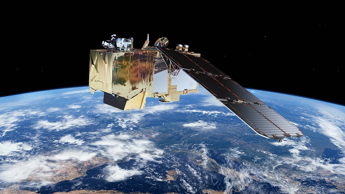
The Laguna Colorada image comes from the Copernicus Sentinel-2 satellites. They carry the MultiSpectral Instrument, or MSI. The instrument records 13 spectral bands covering visible light, near-infrared wavelengths, and shortwave infrared. Four bands provide 10-metre resolution, six provide 20-metre resolution, and three atmospheric bands provide 60-metre resolution.
Four of those bands operate at 10 metres and cover blue, green, red and near-infrared wavelengths. That combination gives Sentinel-2 a useful set of measurements for studying land and water across large areas.
Clear skies!
See more from DIYPhotography.net on Google
Add DIYPhotography.net as a trusted source. This makes
our stories more likely to appear in your Google Search results.
 Add as a preferred source on Google

Soumyadeep Mukherjee
Soumyadeep Mukherjee is an award-winning astrophotographer from India. He has a doctorate degree in Linguistics. His work extends to the sub-genres of nightscape, deep sky, solar, lunar and optical phenomenon photography. He is also a photography educator and has conducted numerous workshops. His works have appeared in over 40 books & magazines including Astronomy, BBC Sky at Night, Sky & Telescope among others, and in various websites including National Geographic, NASA, Forbes. He was the first Indian to win “Astronomy Photographer of the Year” award in a major category.


Join the Discussion
DIYP Comment Policy
Be nice, be on-topic, no personal information or flames.