


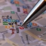
This app uses Google’s location history to geotag your photos.
Jul 24, 2018
John Aldred
John Aldred is a photographer with over 25 years of experience in the portrait and commercial worlds. He is based in Scotland and has been an early adopter – and occasional beta tester – of almost every digital imaging technology in that time. As well as his creative visual work, John uses 3D printing, electronics and programming to create his own photography and filmmaking tools and consults for a number of brands across the industry.
Share:

We hear a lot these days about privacy, especially when it comes to our smartphones and social media. There’s the constant paranoia of being “spied” on by these big companies, and the amount of data they’re collecting on us.
Well, what if we could use some of that data to our own advantage? That’s what software developer Chuck LePlant has done. His new Python script adds GPS tags to your photos based on your Google location history.

Chuck got the idea from Google Photos. He says he has hundreds of thousands of photos on there that he’s taken over the years. One of the features they offer is geotagging. But when he exports the photos out of Google, that geotag information isn’t there in the images metadata. After some research, he discovered that it’s not possible to export the geotags, but you can download your location history.

The script Chuck wrote looks through this location history data and compares the timestamps to those of his photographs. It then injects the geotagging information into the jpg images based on the closest timestamps.
Chuck says that the script works “surprisingly well”, but does also advice backing up before you run it, just to be safe.
You can find out more on Chuck’s blog, and get the full script here.

John Aldred
John Aldred is a photographer with over 25 years of experience in the portrait and commercial worlds. He is based in Scotland and has been an early adopter – and occasional beta tester – of almost every digital imaging technology in that time. As well as his creative visual work, John uses 3D printing, electronics and programming to create his own photography and filmmaking tools and consults for a number of brands across the industry.
Related Posts
 History.JPG: The American Museum of Natural History Digitizes its Photography Collection for Online Public Access
 8 location scouting tips from a pro location manager
 Android 11 will restrict third-party camera app access to stop them stealing location data
 This app uses phone camera to measure your blood pressure
Join the Discussion
DIYP Comment Policy
Be nice, be on-topic, no personal information or flames.
2 responses to “This app uses Google’s location history to geotag your photos.”
Sounds very similar to the app “GeoTag Photos” which uses the phone’s gps/time, matches it to the time stamp on your photos, and then adds the gps info right into the exif.
Please try out my Android Application: play.google.com/store/apps/details?id=com.levionsoftware.photo_map_for_google_photos